Search for:

BAE Systems to Receive USAF Contract to Support Mission Data Loads for F-35

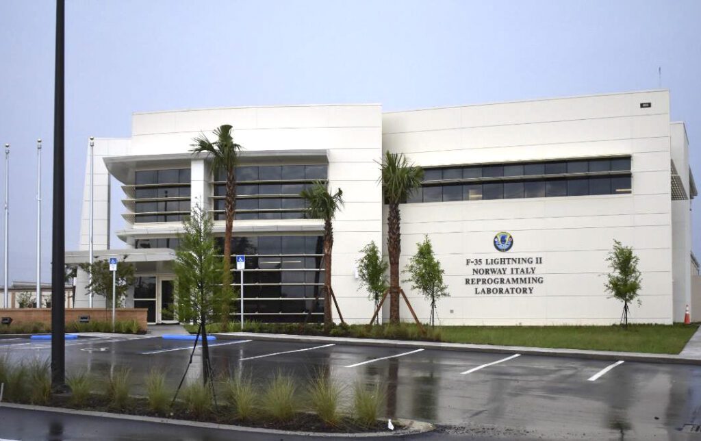
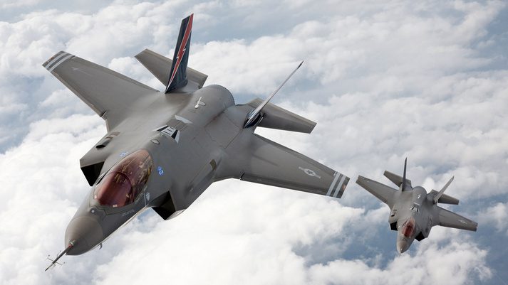
The U.S. Air Force Test Center plans to award the electronic systems sector of BAE Systems a 5-year contract to support the testing of mission data loads at Eglin AFB in Florida for the Lockheed Martin F-35 fighter. Pictured above, the Norway Italy Reprogramming Lab (NIRL) at Eglin Air Force Base, Florida, provides Norway and Italy with F-35 mission data files to assess what threats to search for and when. (Photo: Eglin AFB)

U.S. Air Force Test Center (AFTC) plans to award BAE Systems’ electronic systems sector in Nashua, N.H., a five-year contract before Oct. 1 to support the testing of mission data loads (MDLs) at Eglin AFB, Fla., for the Lockheed Martin [LMT] F-35 fighter.

The award stems from a notice last year by Eglin’s 350th Spectrum Warfare Wing that sought such industry support  (Defense Daily, Nov. 23, 2022).

While AFTC said that the contract to BAE Systems has a relatively low cap of $4.5 million, the continual development of MDLs is crucial, as such MDLs allow the F-35 to use updated maps and identify and counter specific, regional threats, including missiles, electronic warfare systems, and adversary fighters. The 350th Spectrum Warfare Wing and the U.S. Reprogramming Laboratory (USRL) at Eglin update MDLs to ensure new software incorporates new regional data.

International MDL efforts for the F-35 include those by the Australia, Canada, and the United Kingdom Reprogramming Laboratory (ACURL) and the Norway Italy Reprograming Lab (NIRL). In June 2019, NIRL stood up at Eglin, while ACURL moved from Lockheed Martin’s F-35 plant in Fort Worth, Texas to Eglin in February 2020.

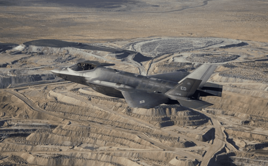
BAE Systems supports the developments and upgrades for combat and fast jet trainer aircraft. (Photo: BAE Systems)

The upcoming MDL support contract to BAE Systems “is for Hardware-in-the-Loop (HITL) Test Facilities Threat Simulators Sustaining Engineering Services (SES) Support providing direct support to the F-35 Partner Support Complex (PSC) ACURL/ F-35 PSC NIRL / F-35 PSC Mission Data Reprograming Lab (XRL)/513th Electronic Warfare Squadron (EWS) USRL,” AFTC said on Jan. 18. “The F-35 PSC NIRL and 513th EWS require management, personnel, equipment, supplies, facilities, transportation, tools, materials, supervision, and other items and non-personnel services necessary to perform sustainment and technical support services of the HITL laboratory testing of simulated regional RF [radio frequency] radar threat signals for the F-35 Mission Data Development Mission program.”

In June 2021, the Air Force stood up the 350th Spectrum Warfare Wing under Air Combat Command to focus on offensive electronic warfare and consolidate all Air Force electromagnetic spectrum efforts (Defense Daily, June 25, 2021). The wing includes the 513th EWS under Eglin’s former 53rd Electronic Warfare Group.

In past years, the Pentagon’s directorate of operational test and evaluation (DOT&E) has pressed DoD to ensure that USRL is able to test and optimize MDLs under realistic threat scenarios. In its fiscal 2021 “controlled unclassified information” report, DOT&E said that there is still work to do to support F-35 Block 4 MDL development.

The report said that “DOT&E remains concerned about the availability of the test infrastructure and resources required to execute the approved Block 4 test programs.”

The Air Force, U.S. Navy, and Marine Corps and operational test (OT) personnel from the F-35 Joint Program Office “have developed a tail-by-tail accounting of current and future OT aircraft, and identified the necessary modifications to OT aircraft and the required instrumentation,” the study said. “Additional work and funding are required to address these and other test-enabling and infrastructure requirements, such as the U.S. Reprogramming Lab for mission data, data sharing networks and storage systems for the test teams, and JSE [Joint Simulation Environment] upgrades. Currently, these requirements are not fully funded, programmed, or scheduled to be completed in time to support Block 4’s DT [developmental test], integrated DT/OT, and dedicated OT activities.”

The F-35 program has planned to finish the final 64 runs of JSE at Naval Air Station Patuxent River, Md., this year to allow the F-35 to proceed to a full-rate production decision.

This article was originally published by Defense Daily, a sister publication of Avionics International. It has been edited. Read the original version here >>

The post BAE Systems to Receive USAF Contract to Support Mission Data Loads for F-35 appeared first on Avionics International.

—————
Boost Internet Speed
Free Business Hosting
Free Email Account
Dropcatch
Free Secure Email
Secure Email
Cheap VOIP Calls
Free Hosting
Boost Inflight Wifi
Premium Domains
Free Domains

FAA Awards Supplemental Type Certificate to Garmin GI 275 for Part 25 Aircraft

Southeast Aerospace, Garmin, and Peregrine recently announced that the Garmin GI 275 Electronic Flight Instrument has been approved by the FAA for installation on Part 25 aircraft. (Photo: Southeast Aerospace)

Southeast Aerospace, Garmin, and Peregrine have recently announced that their new product, the Garmin GI 275 3.125-inch round display Electronic Flight Instrument, has been approved by the Federal Aviation Administration for installation on Part 25 aircraft. This instrument promises to be a cost-effective replacement of both mechanical and electronic standby instruments.

The benefits of this upgraded cockpit instrument are best summarized by Luke Gomoll, an Aircraft Sales Representative for Southeast Aerospace. He explained, “The Garmin GI 275 ESI elevates the cockpit. Display clarity, brightness, data presentation, and data accuracy are all leveled up massively with the GI 275 compared to legacy electronic standby instruments. Obsolescence of older ESIs is really a secondary reason to upgrade to the GI 275, and we think that the GI 275 ESI has enough merit on its own to justify upgrades of non-obsolete equipment as well.”

This new instrument has virtually all of the features of its predecessor, including traditional knob controls, while now offering a modernized look and a glass touchscreen display that is readable even in intense sunlight. Despite advancements like this, it can still be mounted in the cockpit in a standard 3 ⅛-inch round cut out. In addition to its touchscreen, the GI 275 is also compatible with more than 1,000 aircraft models. It displays attitude while saving weight and costs associated with maintenance, since the attitude indicator is driven by ADAHARS rather than a heavier vacuum pump. Furthermore, it displays altitude and airspeed (integrated into one display), connects cockpits to built-in Wi-Fi, features Bluetooth technology, and boasts an hour worth of backup battery power. This improved device can also be integrated with autopilot while providing precise information regarding an aircraft’s location and position.

The Garmin GI 275 can help under challenging circumstances for pilots. If paired with the GTN Xi series navigator, it enables Smart Glide. In the event of an engine failure, this program can help pilots land by finding nearby airports and creating a direct route for a timely and safe touchdown. Furthermore, it accepts speed and distance indications along with inputs for VOR/LOC.

Moving forward, the Garmin GI 275 will be able to replace aging ESI instruments on a variety of Part 25 aircraft. While this aircraft category includes larger types like the Boeing 737 and Airbus A320 family, it also includes a considerable amount of business jets like the Cessna Citation 550/560/560XL, the Gulfstream G200/GIV/GV, the Falcon 50, Lear 60, and many more. Because this instrument is mounted on the cockpits of a wide variety of aircraft, it seems operators, pilots, and passengers alike can enjoy the cost efficiency, convenience, and safety this new instrument has to offer the industry.

The post FAA Awards Supplemental Type Certificate to Garmin GI 275 for Part 25 Aircraft appeared first on Avionics International.

—————
Boost Internet Speed
Free Business Hosting
Free Email Account
Dropcatch
Free Secure Email
Secure Email
Cheap VOIP Calls
Free Hosting
Boost Inflight Wifi
Premium Domains
Free Domains

Vortex Aircraft Services Signs Agreement to Use Embraer’s Beacon Platform

Embraer has signed a contract with Vortex Aircraft Services for the use of Beacon, a multi-sided platform to support operators, MROs, and technicians. Pictured above, an aircraft maintenance mechanic inspects a jet engine. (Photo: Embraer)

Recently, Brazilian aircraft manufacturer Embraer signed an agreement with Vortex Aircraft Services for the use of Beacon, a digital platform powered by Embraer-X that helps aircraft return to service quicker through the coordination of resources and mechanics needed for aircraft maintenance and repair. This partnership promises to bring more benefits to both companies while fueling Beacon’s growth into the U.S.

Vortex Aircraft Services was founded in 2017 and serves businesses in need of assistance with aircraft management, scheduled inspections, pre-aircraft purchase inspections, and other AOG (aircraft on ground) services. It also offers consulting services to its clients. Meanwhile, Beacon is an online platform powered by Embraer that allows for improved coordination within and the streamlining of various maintenance channels. Vortex’s use of Beacon will allow it to better serve its clients through better coordination of resources needed for its services, and in an even more timely manner.

As Marco Cesarino, Head of Beacon, explained,“As a fleet-agnostic platform, Beacon is an ideal partner for Vortex, a company providing maintenance and repair services on a broad range of aircraft from different original equipment manufacturers. Every minute counts in aviation. Beacon will help Vortex improve their coordination efficiency of AOG events and field maintenance, foster more effective collaboration, and maintain their high standards of quick response to critical maintenance events.”

This new partnership also helps Beacon expand into a new market. Vortex’s presence in the United States, specifically the southern region of the country, will connect Beacon to geographic areas previously left unreached and in need of coordinated and streamlined maintenance support.

Luis Osuna, Director of Maintenance for Vortex, highlighted the benefits of this partnership when he explained, “We firmly believe in strengthening the quality of work and response for our customers. The Beacon platform aligns with our vision to expand in Charlotte, NC, which remains a strategic location for Vortex and its customers as a hub for air carriers and all operations traveling through the Southeast United States.”

Embraer’s platform Beacon, though relatively new to the market, seems to have been met with enthusiasm from the aviation industry. In addition to Vortex Aircraft Services, several other aviation companies have signed agreements for the use of Beacon. In fact, it was recently applied to the commercial sector of the industry—Embraer-X just signed an agreement with European MRO provider Aero-Masters for the use of Beacon. The coordination this platform provides will help Aero-Masters keep commercial passengers flying safely across Europe. JetBlue is another customer of the Beacon platform.

Aviation is a dynamic industry with ever-changing demands. However, the success of Beacon indicates the importance of using technology and innovation to find more efficient approaches to aviation services.

The post Vortex Aircraft Services Signs Agreement to Use Embraer’s Beacon Platform appeared first on Avionics International.

—————
Boost Internet Speed
Free Business Hosting
Free Email Account
Dropcatch
Free Secure Email
Secure Email
Cheap VOIP Calls
Free Hosting
Boost Inflight Wifi
Premium Domains
Free Domains

Startup AirNova Plans Vertiport Network in France

A French startup, AirNova, is working towards establishing a network of vertiports—sites for take-offs and landings of small electric air taxis as well as drones. (Photo: AIRNOVA)

A French startup, AirNova, is working towards establishing a network of vertiports—sites for take-offs and landings of small electric air taxis as well as drones. The company aims to become the leading vertiport operator in France via regional development.

According to a representative of the company, there are currently about 20 sites being evaluated as potential vertiport locations. AirNova’s spokesperson shared in an emailed statement to Avionics International that after the first operational sites are validated, they plan to build up to 20 new vertiports each year. 

“Our rooftop Vertiport projects are new constructions that meet the criteria of specifications in line with the expectations of the competent authorities such as the DGAC [the French Civil Aviation Authority]/DSAC [Civil Aviation Safety Directorate], EASA, etc.,” the representative wrote.

“We plan to develop partnerships with European players to extend the coverage of Airnova veriports in several European countries, initially bordering on France.” (Photo: AIRNOVA)

AirNova’s spokesperson noted that their vertiports will be designed to accommodate vehicles with a take-off and landing weight under 3,175 kilograms. “Some of the vertiports and vertihubs will be equipped with charging, maintenance, and storage systems for eVTOLs [electric vertical take-off and landing] and drones,” they added.

AirNova has requested an extension of its French patent to Europe, the representative shared. “We plan to develop partnerships with European players to extend the coverage of AirNova veriports in several European countries, initially bordering on France,” they wrote.

Laurent Mathiolon has been working on the concept of buildings equipped with vertiports for more than four years, and he filed a patent for the concept with the National Institute of Industrial Property in France in 2020. The patent was formally accepted two years later, and Mathiolon created the AirNova startup. Soon after that, in October 2022, the company announced a campaign to raise €3 million. This funding will be used for feasibility studies and construction of the first demonstration sites.

The company has adopted the tagline, “The place between the sky and the city.” (Photo: AIRNOVA)

In an interview last year, Mathiolon explained that many forms of public transportation—and especially roads—are nearing saturation in all major cities around the world. One area that has not yet been utilized to its potential is the airspace that exists between 50–150 meters above sea level.

The AirNova team envisions three initial applications for its vertiport network: healthcare, package delivery, and transportation. Another potential application is for firefighting operations. Mathiolon commented, “We want to be able to provide fast water supply [and] allow specialized drones to be able to use our vertiports to get there [immediately],” before larger vehicles might be able to get to the site.

The AirNova team envisions three applications for its vertiport network: healthcare, package delivery, and transportation. (Photo: AIRNOVA)

The post Startup AirNova Plans Vertiport Network in France appeared first on Avionics International.

—————
Boost Internet Speed
Free Business Hosting
Free Email Account
Dropcatch
Free Secure Email
Secure Email
Cheap VOIP Calls
Free Hosting
Boost Inflight Wifi
Premium Domains
Free Domains

Airbus UpNext and Acubed Test New Technologies for Pilot Assistance

Airbus UpNext and Acubed are evaluating the use of automated technologies for pilot assistance. Pictured above is the A350-1000 flight lab. (Photo: Airbus/Acubed)

A wholly owned subsidiary of Airbus, called Airbus UpNext, announced recently that it has started testing new pilot assistance technologies with an A350-1000 test aircraft. Automated emergency diversion in cruise, automatic landing, and taxi assistance are the three technologies undergoing evaluation. The Airbus UpNext team aims to explore the use of autonomous flight systems to support operations with greater levels of safety and efficiency.

Acubed, the Silicon Valley innovation center of Airbus, collaborated with Airbus UpNext in 2020 to conduct autonomous taxiing, take-off, and landing with a commercial aircraft. The vehicle utilized image recognition powered by artificial intelligence technology developed at Acubed. The new demonstrator—DragonFly—was launched by Airbus UpNext (in partnership with Acubed) in 2022.

Airbus UpNext also announced that it is launching a project to advance next-generation computer vision-based algorithms in support of landing and taxi assistance.

“Vision-based machine learning is a key tech enabler for autonomous ground vehicles,” according to an article by engineer Cedric Cocaud about the role of data curation and data labeling for vision-based machine learning and AI.” Cocaud added, “It is able to accurately single out objects of interest in an image, reliably classify them and determine their precise position within the image.”

Arne Stoschek, Acubed’s Head of AI and Autonomy, explained in an interview with Avionics International that the objective of the DragonFly demonstrator is to explore new technologies for pilot assistance. “The main goal for looking at those technologies is to enhance flight safety and aircraft operational capabilities and efficiencies,” Stoschek said.

Developing machine learning algorithms to enable global coverage requires large quantities of data from a large number of airports. (Photo: Airbus/Acubed)

Acubed and Airbus UpNext are working together to enable an aircraft to perceive objects and events in its environment and to maneuver autonomously while maintaining safety. The partners are also looking at topics such as reducing pilot workloads, de-risking emergency operations, and enabling aircraft to communicate autonomously with air traffic management.

“We are working on developing the means to ensure these types of functions globally, at any airport where Airbus aircraft can land, and in any weather conditions,” Stoschek noted. He explained that they are looking at varying conditions—for example, approaching an airport at night is very different from a daytime approach. “At nighttime, approaching an airport, it’s pretty much an ocean of blinking light.”

Another topic that Airbus UpNext and Acubed are working on is global scalability. Key to addressing this is the “availability of artificial intelligence—specifically machine learning technologies for perception,” he said. “That’s a specific technology developed in other applications, such as for autonomous driving applications, that we make useful for our specific application of flight.” 

DragonFly is a demonstrator developed by Airbus UpNext to explore new pilot assistance technologies that can advance flight safety and aircraft operational efficiency. (Photo: Airbus UpNext)

Quick iteration and prototyping are two central development paradigms at Acubed. Stoschek explained, “This approach allows rapid development, iterative software development processes, and connecting the technologies to the requirements of the aircraft.”

Developing machine learning algorithms to enable global coverage requires large quantities of data from a large number of airports. “It’s a very large scale data processing topic to automatically process the data—to train the machine learning algorithms, data has to be in a specific format and needs to be annotated,” Stoschek commented.

There are essentially two methods to accumulate the large amounts of data necessary. The first is to conduct flights and collect data directly, which comes with concerns about cost and availability, Stoschek said. The other method is synthetic data generation. Acubed uses computer-based technologies, including a digital twin, to recreate or generate data. Testing different situations such as noncooperative traffic would be very expensive without the use of simulation and collection of synthetic data.

The post Airbus UpNext and Acubed Test New Technologies for Pilot Assistance appeared first on Avionics International.

—————
Boost Internet Speed
Free Business Hosting
Free Email Account
Dropcatch
Free Secure Email
Secure Email
Cheap VOIP Calls
Free Hosting
Boost Inflight Wifi
Premium Domains
Free Domains

Airspace Monitoring for Drones: A Q&A With Hidden Level’s CEO

Jeff Cole, CEO of Hidden Level, recently shared his thoughts with Avionics International on Remote ID technology, the safe integration of drones into the airspace, and the advantages of the company’s Airspace Monitoring Service. (Photo: Hidden Level)

At the end of last year, the Federal Aviation Administration mandated that all uncrewed aircraft made or sold in the United States must transmit Remote Identification information. By Sept. 16, 2023, drone pilots will also be required to register and operate their vehicles in accordance with the final rule on Remote ID.

Drone sensing company Hidden Level has developed a technology called the Airspace Monitoring Service, or AMS, which can be used to track Remote ID. Hidden Level’s AMS solves two potential problems with the Remote ID system—drones that fail to broadcast information and those that broadcast false Remote ID information.

Last year, Hidden Level’s team deployed its AMS for evaluation by the FAA as both a standalone solution and a complementary technology for Saab’s SAFE Airport Event Management system. In an announcement this week, the company confirmed that it will continue to support the FAA’s Airport Unmanned Aircraft Systems (UAS) Detection and Mitigation Research Program.

Hidden Level collaborates with NASA’s Ames Research Center to evaluate the use of its Airspace Monitoring Service for drone traffic management. The company is also a partner of Joby Aviation, a developer of electric vertical take-off and landing (eVTOL) aircraft. 

Hidden Level’s CEO Jeff Cole recently shared his thoughts with Avionics International on Remote ID technology, the safe integration of drones into the airspace, and the advantages of their AMS. Check out our question-and-answer session with Jeff Cole below.


Avionics: Can you share some background about the company?

Jeff Cole: The existing air traffic system and surveillance infrastructure that’s been in place for decades to monitor manned aircraft was never designed for this low-altitude mission over cities, where we’ll have to monitor potentially hundreds of drones and urban air mobility vehicles. 

Hidden Level was created about four and a half years ago. Our focus was bringing disruptive technology to the industry in a disruptive business model.

How do we bring some really cutting-edge technology to market and provide performance and access to it? That’s our airspace monitoring service, which is the cornerstone of our product offering. We’ve built this technology that we own and maintain, and we deploy it on existing infrastructure such as rooftops and cell towers. The focus is on blanketing low-altitude urban airspace to monitor manned aircraft and drone traffic to help scale and enable advanced air mobility initiatives—drone delivery, urban air mobility—while at the same time addressing security and safety concerns.

Hidden Level HL1000 sensor installation at Syracuse Hancock International Airport (Photo: Hidden Level)

Could you tell us more about how Hidden Level’s Airspace Monitoring Service technology works and how the AMS verifies Remote ID signals?

Cole: The technology is completely passive in its capability and is also privacy-compliant. A lot of passive technologies will demodulate or pull signal information and grab location from the signal. Our technology works very differently. It is able to hear a signal and then triangulate where it is. 

If you are in a room with 100 different people and they are all speaking different languages, rather than understanding French, and hearing the French person say, “I’m over in the left corner of the room,” we pick up and say, “That’s a French-speaking individual, I can tell by the phonetic characteristics. I can’t understand what they’re saying, but I can hear them, and they’re actually over in the left side of the room, or the right side of the room. That’s where it’s really synergistic to the Remote ID aspect.

Remote ID is meant to be like an identifiable license plate and a transmission of where you are. If I’m a drone flying around, I’m saying, this is my GPS location and here’s my license plate. We get that information and also detect where it is by hearing a signal in space and we verify and validate that the target is real, the position being reported is accurate, and it’s not spoofed. If you just relied on that signal telling you where it is, you don’t know if it’s actually there. We look at the phonetic characteristics of waveforms in space, we look at the GPS position being reported, and confirm that position is currently accurate and real. That is the Remote ID verification and validation part, which is very different than anything else out there.

There are a lot of different systems that can receive Remote ID. We are a broad frequency solution. We are really built for evolution. As we scale, the technology potentially moves into other frequency areas, we’re still able to detect, verify, and validate those positions.


Have there been any recent trends in what the company’s clients are concerned about or what problems they hope to solve?

Cole: On the security side of things, once you show them the amount of traffic out there, that triggers a lot of concern. How do I get the data in a privacy-compliant manner, and how is this technology scalable for the future as things start to move into 5G or different aspects of the spectrum based on what the SEC may allocate? They want to know that ultimately, this isn’t just a solution for today—they want to know how it is a solution for tomorrow.

When it comes to the advanced air mobility side, it’s being able to see where all of the different drones are and also seeing where manned aircraft are. That’s another aspect of our system; it has the ability to do passive detection of manned aircraft in a pretty unique way. That’s a really key aspect of enabling the future of drone delivery, urban air mobility: How do we scale technology that has the ability to see manned aircraft and drones in a cost-effective manner?

Our airspace monitoring service is a really disruptive offering. We make it accessible and affordable for people because we’re able to share that across a lot of different users and monetize across a lot of aspects of the business versus just selling a piece of hardware for that purpose.

Customers are asking how the data gets to the FAA or somewhere else. If I sold them a piece of hardware to do that, they’re now responsible for that data. The AMS can integrate into all of the different parties that need that information to work in harmony. When it comes to a security mission, for example, you might have a stadium, a first responder or officer, and potentially an agency that’s involved, depending on what’s happening or the severity of the event. Each user has different operations to work in. Our data can integrate into each one, and they can work in harmony quicker and reference the same information.

When it comes to advanced air mobility, our data can feed into different types of services that are doing detect and avoid, or providing that information to air traffic control, et cetera. We needed to make something that is scalable and accessible to everyone at the same time.

The post Airspace Monitoring for Drones: A Q&A With Hidden Level’s CEO appeared first on Avionics International.

—————
Boost Internet Speed
Free Business Hosting
Free Email Account
Dropcatch
Free Secure Email
Secure Email
Cheap VOIP Calls
Free Hosting
Boost Inflight Wifi
Premium Domains
Free Domains

Defense Updates: Counter-UAS, Collaborative Combat Aircraft, and the F-35 Program

This week, we are featuring updates from Defense Daily, including topics such as counter-UAS, the F-35 program, and Collaborative Combat Aircraft. The Border Patrol uses BlueHalo’s Titan counter-UAS, pictured above. (Photo: BlueHalo)

DHS Seeks Information On Counter-UAS In Various Operational Modes

The Department of Homeland Security this week released a Request for Information (RFI) for counter-drone systems for use in various configurations, from fixed-site to person-portable, to meet operational needs.

The Jan. 10 RFI was issued by the Secret Service to assess the availability of at least relatively mature technologies to detect, track, identify, classify and potentially defeat unmanned aircraft systems (UAS) in a number of operational settings around-the-clock.

“DHS has an operational need for fixed site as well as rapidly deployable, mobile, and single person-portable employment modes to provide situational awareness and mitigation capabilities for personnel in the field,” the RFI says.

DHS is looking for capabilities that are at least at a Technology Readiness Level 6, which signifies a technology has completed the last development stage and has successfully been tested and evaluated in a simulated operational environment.

Drones of interest to be detected can be any size and weight, as well as fixed-wing, vertical-take-off-and-landing, or a hybrid, the RFI says.

After reviewing responses, DHS may host a product demonstration for some of the systems to learn more about the available capabilities in an operational setting.

Some DHS components, including Border Patrol, the Coast Guard and Secret Service, do conduct counter-UAS operations. The Department of Homeland Security Science and Technology Directorate and the Transportation Security Administration are assessing these technologies in various operational settings, including airports. Responses are due by Feb. 7.


Avenger Drone Advances Collaborative Combat Aircraft Concept, General Atomics Says

General Atomics Aeronautical Systems Inc. (GA-ASI) said on Jan. 11 that a company-owned MQ-20 Avenger drone advanced the company’s internally funded work on Collaborative Combat Aircraft (CCA) in three autonomous missions last month.

On Dec. 14, the Avenger, paired with “digital twin” planes, conducted simulated combat missions from GA-ASI’s Desert Horizons flight operations facility in El Mirage, Calif., and the company’s Reinforcement Learning (RL) architecture, developed using industry-standard tools, including Docker and Kubernetes, allowed the artificial intelligence/machine learning (AI/ML)-enabled Avenger  “to validate three deep learning RL algorithms in an operationally relevant environment,” GA-ASI said.

The company said that its CCA “ecosystem” will provide “a new and innovative tool for next-generation military platforms to make decisions under dynamic and uncertain real-world conditions.”

During the Dec. 14 Avenger missions, the “single agent RL model successfully navigated the live plane while dynamically avoiding threats to accomplish its mission,” GA-ASI said on Jan. 11. “Multi-agent RL models flew a live and virtual Avenger to collaboratively chase a target while avoiding threats. The hierarchical RL agent used sensor information to select courses of action based on its understanding of the world state…This live operational data describing AI pilot performance will be fed into GA-ASI’s rapid retaining process for analysis and used to refine future agent performance.”

The company said that the Dec. 14 tests used a government-furnished Collaborative Operations in Denied Environment (CODE) autonomy engine, government-standard Open Mission System messaging for linking the RL agents, and a General Dynamics EMC2 open-architecture, multi-function, multi-level security processor—the so-called “Einstein box”—to speed testing for various missions.


Northrop Grumman Developing New AN/APG-85 Radar for F-35 Lot 17 and Beyond

Northrop Grumman said on Jan. 11 that it is developing the AN/APG-85 Active Electronically Scanned Array (AESA) radar for Lot 17 and beyond of the Lockheed Martin F-35 fighter.

The APG-85 will be the follow-on to the F-35’s current AN/APG-81 AESA radar, built by Northrop Grumman at its Linthicum Heights, Md., plant.

“The capability of the F-35 advanced radar will enhance the DoD’s ability to execute the National Defense Strategy in the future,” the F-35 Joint Program Office (JPO) said in a Jan. 11 response to questions. “Therefore, certain information will continue to be protected by enhanced security measures due to the critical nature of the technology.”

The F-35 JPO did not reveal what features the APG-85 will have that the APG-81 does not, but said that the APG-85 “is modernized to be the top-of-the-line radar available today, ensuring American dominance in the air.”

The F-35 program declined to release funding and contract details for the APG-85. The F-35 JPO has said that the APG-81 has 1,676 Gallium Nitride (GaN) transmit/receive (T/R) modules, but the F-35 JPO and Northrop Grumman declined to say whether the APG-85 will also be a Gallium Nitride-based radar.

We do not disclose technical information on operational capabilities,” the F-35 JPO said on Jan. 11.


F-35 Program Announces First Technology Refresh-3 Flight

An F-35A flies for the first time with the TR-3 configuration above the Mojave Desert in California on January 6. (Photo: F-35 Joint Program Office)

A developmental test team from the 461st Flight Test Squadron at Edwards AFB, Calif., flew the Technology Refresh-3 (TR-3) configuration of the Lockheed Martin F-35 fighter for the first time on Jan. 6, the F-35 Joint Program Office (JPO) said on Jan. 10.

The F-35 JPO said that U.S. Air Force Maj. Ryan “BOLO” Luersen piloted tail number AF-7, “a specially instrumented flight test aircraft and the first with TR-3 upgrades installed.”

“He executed a functional check flight (FCF) profile to verify aircraft airworthiness and system stability,” the F-35 program said. “The 50-minute flight, which took the jet to 35,000 feet at speeds just shy of the speed of sound above the Mojave Desert, marked the start of an extensive flight test campaign. Developmental and operational test flights will continue through 2023 to ensure safety and prove warfighting capabilities.”

Last week, the Pentagon and Lockheed Martin said that it is uncertain when resumption of deliveries and flight acceptance testing of the F-35 will start, as the Naval Air Systems Command (NAVAIR) investigation of an F-35B mishap on Dec. 15 continues (Defense Daily, Jan. 3).

In the Dec. 15 incident, the pilot of a Lockheed Martin-owned F-35B ejected on the runway at Naval Air Station Joint Reserve Base Fort Worth, Texas.

On Dec. 30, Lockheed Martin said in a statement that the F-35 JPO and the company had finalized a Lot 15-16 contract that may be worth $30 billion to build and deliver up to 398 F-35s domestically and internationally. Those lots are to include TR-3.

Powered by the L3Harris integrated core processor, TR-3 is the computer backbone for Block 4, which is to have 88 unique features and integrate 16 new weapons on the F-35.

“The TR-3 program has overcome technical complexity challenges with hardware and software, and is now on-track to deliver capability to the U.S. and its allies starting in 2023,” the F-35 program said on Jan. 10. “The government and industry team continue to find innovative ways to ensure delivery of critical capabilities to defeat future threats. Lessons learned in the execution of the TR-3 program will be applied across the entire Block 4 modernization program.”

Among the challenges that the F-35 program and industry have said that they are addressing is a parts shortage for the Northrop Grumman AN/AAQ-37 Distributed Aperture System (DAS), which is to provide 360 degreee awareness for F-35 pilots from six infrared sensors that feed data to the pilot’s helmet (Defense Daily, Nov. 9, 2022).

Plans have called for the integration of the Raytheon Technologies’ Next-Generation electro-optical DAS (EO DAS) into all F-35s beginning this year with Lot 15 under TR-3.


These articles are abridged and edited from Avionics International‘s sister publication, Defense Daily. Check out the original articles at the links below:

DHS Seeks Information On Counter-UAS In Various Operational Modes

Avenger Drone Advances Collaborative Combat Aircraft Concept

Northrop Grumman Developing New AN/APG-85 Radar for F-35 Lot 17 and Beyond

F-35 Program Announces First Technology Refresh-3 Flight

The post Defense Updates: Counter-UAS, Collaborative Combat Aircraft, and the F-35 Program appeared first on Avionics International.

—————
Boost Internet Speed
Free Business Hosting
Free Email Account
Dropcatch
Free Secure Email
Secure Email
Cheap VOIP Calls
Free Hosting
Boost Inflight Wifi
Premium Domains
Free Domains

FAA Implements Internationally Recognized Program to Improve Aviation Safety

The FAA recently expanded internationally recognized aviation safety standards to all commercial aircraft operators and manufacturers. (Photo: Jessica Reed)

The U.S. Department of Transportation’s Federal Aviation Administration approved a new program to decrease aviation safety risks in a new ruling. Based on international safety standards and recommendations from independent review panels, this 2023 ruling applies to all aircraft manufacturers and operators of commercial, air tour, and charter flights. Early findings indicate that this ruling could reduce the number of aviation accidents and save lives.

This move expands upon the safety regulations established in the Aircraft Certification, Safety, and Accountability Act. This 2020 act was in response to two crashes of the popular 737 MAX aircraft in Indonesia and Ethiopia. It increased safety standards for aviation manufacturers but didn’t address aircraft operators.

When discussing the differences between these two, the FAA press release stated, “The proposed rule goes beyond the requirements of the Aircraft Certification, Safety and Accountability Act of 2020, which directed the FAA to mandate SMS only for aircraft manufacturers.”

While the 2020 act was responsive to these crashes, this new rule is a preventative measure based on international safety regulations. More specifically, it’s based on the Safety Management Systems (SMS), a standard set of safety measures recognized by the Joint Planning and Development Office (JPDO), International Civil Aviation Organization (ICAO), and Civil Aviation Authorities (CAA).

SMS provides a structured list of decision-making protocols, risk control and safety assurance processes, and a framework which promotes a safety focused culture. All protocols and policies fall under four components: safety risk management, safety policy, safety promotion, and safety assurance.

Along with implementing the SMS standards, the new rule also considers recommendations from independent review panels and the National Transportation Safety Board. There is also a public comment period over the next 60 days, during which there could be adjustments to the new ruling.

All manufacturers and commuter, air tour, and charter aircraft operators must comply with the new ruling within one to two years. The exact time frame depends on each operator’s implementation capabilities. Some major aircraft carriers, such as Boeing, Bell, GE, P&W, and Sikorsky, have already implemented many measures in this new ruling with great success.

By applying internationally-recognized and proactive safety protocols to all members of the aviation industry, the FAA hopes to reduce the number of aviation accidents. Acting FAA Administrator Billy Nolen explained, “Expanding Safety Management Systems to other players in the aviation industry will reduce accidents and incidents and save lives.”

The post FAA Implements Internationally Recognized Program to Improve Aviation Safety appeared first on Avionics International.

—————
Boost Internet Speed
Free Business Hosting
Free Email Account
Dropcatch
Free Secure Email
Secure Email
Cheap VOIP Calls
Free Hosting
Boost Inflight Wifi
Premium Domains
Free Domains

NOTAM Outage Results in Nationwide Flight Disruptions

A photo taken at Hartsfield-Jackson Atlanta International Airport on Jan. 11 (Photo: Reuters/Alyssa Pointer)

After a turbulent holiday season, it seems that travel disruptions in the U.S. are continuing to emerge. However, most recently it was a Federal Aviation Administration system outage, not inclement weather or airline-caused delays, that sparked widespread disruptions across the nation. Though occurring briefly on Wednesday morning, the effects rippled across the airline industry in subsequent hours.

The issue was with the FAA’s Notice to Air Missions (NOTAM) system, a computer network that notifies flight crew members of changes that can affect operations—most notably, factors like changes in weather, runway use, or restricted air space. This program is crucial for safe flight operations. Often, the information provided by the NOTAM system concerns smaller details. It can also provide critical information that a flight crew must know in order to fly and land safely. 

The NOTAM system went out around 8:28 p.m. EST on Tuesday, Jan. 10, causing the FAA to resort to using a telephone hotline to avoid a ground stop. However, by around 7:00 a.m. EST on Jan. 11, traffic volumes overwhelmed this approach, forcing the FAA to set in place a 90-minute ground stop. This halted all domestic departures across the country.

Many departures were able to take off by 8:50 a.m. EST, but the effects on airline schedules were significant. In total, over 10,000 flights were delayed and another 1,300 were canceled. The largest carriers in the U.S.—American Airlines, Delta Air Lines, Southwest Airlines, and United Airlines—all reported that at least 40% of their Wednesday flights were delayed or canceled. Despite the disruptions, many officials remained confident that a return to mostly-normal operations could be reached by Thursday. Passengers were instructed to check with their airlines for updated flight information.

Since the incident, an investigation has been launched to find the cause of the problem. Currently, the FAA has found no evidence of a cyberattack, and instead believes that a damaged database file corrupted both the NOTAM and its backup system. This conclusion was drawn from a preliminary investigation, and a final cause has not yet been determined.

In a statement, the FAA explained that their team “is working diligently to further pinpoint the causes of this issue and take all needed steps to prevent this kind of disruption from happening again.”

In a winter full of flight disruptions, the NOTAM system’s outage is the most recent cause of delays and cancellations. Many airlines were forced to cancel flights during the holiday rush as a result of inclement weather and staffing challenges, and these factors played a key role in Southwest Airlines’ operational meltdown that left thousands of passengers stranded across the country. More recently, an issue with the FAA’s En Route Automation Modernization system at its Miami Control Center led to significant disruptions across Florida. Now that demand for air travel is returning, it seems that the aviation industry’s technological infrastructure is yet another challenge the industry must address to preserve reliability and safety.

The post NOTAM Outage Results in Nationwide Flight Disruptions appeared first on Avionics International.

—————
Boost Internet Speed
Free Business Hosting
Free Email Account
Dropcatch
Free Secure Email
Secure Email
Cheap VOIP Calls
Free Hosting
Boost Inflight Wifi
Premium Domains
Free Domains

Airbus and VDL Announce Partnership to Develop UltraAir

Airbus and VDL Group are partnering to develop and manufacture UltraAir, a laser communication terminal for aircraft. (Photo: Airbus)

While the aviation industry has maintained a consistent focus on the creation and implementation of new aircraft designs, other advancements in the industry are promising to bring great value to the aviation world. European aircraft manufacturer Airbus and high-tech Dutch producer VDL Group have just announced a partnership to design and build UltraAir, a laser communication terminal. With the support of development from Airbus and the Netherlands Organization for Applied Scientific Research (TNO), the organizations hope to have a prototype and a first flight test completed by sometime next year.

UltraAir is a laser communication terminal with improved capabilities that make the more efficient transfer of data and information possible. Airbus has been developing the system since April of 2021 and has designed it to utilize laser links between a set of satellites in orbit and terminals on the ground equipped with a precise optical mechatronic system. 

“Laser communication technologies are the next revolution in satellite communications (satcom).” (Photo: European Space Agency)

UltraAir promises to address many of the challenges the use of radio frequency bands for communications present by having improved anti-jamming, a lower chance of interception and secure data transfers of 1.8Gbit/s. Additionally, it will allow the sharing of larger amounts of data through its use of the SpaceDataHighway satellite constellation, a project supported by Airbus and the European Space Agency that has allowed for thousands of connections since its conception over five years ago. As traditional satellite communication (satcom) radio-frequency bands struggle from more bottlenecks (which occur when they cannot handle the current volume of data due to inadequate handling capacity), the improved capabilities of UltraAir promise to be a step forward for communications in the aviation industry.

By next year, Airbus and VDL Group will further develop the prototype so it will be ready for integration with a test aircraft. VDL will be responsible for designs used during production and for manufacturing several critical systems needed to operate. Once completed, Airbus and VDL hope to have this further industrialized prototype flight tested by 2025.

UltraAir offers many opportunities to improve various sectors of the aviation industry. Features like its use of the SpaceDataHighway will allow both unmanned aerial vehicles (UAVS) and military aircraft to connect in a multi-domain combat cloud, which will allow aircraft in the armed forces to combat more collaboratively and thus more efficiently. Beyond military aviation, the system could also be installed on commercial aircraft, which could give airlines the opportunity to offer high-speed connections to the flying public.

Airbus, TNO, and the VDL Group’s collaborative effort could bring further improvements to communications, regardless of the industry sector utilizing it. Laser communication can move 1,000 times more data than traditional satcom radio-frequency bands, and can do so 10 times quicker as well. Laser links have a narrower beam, making it much more difficult to be intercepted. Thanks to this, the laser terminals on the ground are lighter and more efficient, all while offering security better than radio.

The advancements found in UltraAir could offer the improved communications vital to maintaining the aviation industry’s safety and efficiency.

The post Airbus and VDL Announce Partnership to Develop UltraAir appeared first on Avionics International.

—————
Boost Internet Speed
Free Business Hosting
Free Email Account
Dropcatch
Free Secure Email
Secure Email
Cheap VOIP Calls
Free Hosting
Boost Inflight Wifi
Premium Domains
Free Domains

Transcom ISP - Transcom VOIP - Free Secure Email - Dropcatch Software - FastApn Inflight - Aero Connect - Premium Domains