Search for:

How Airports Can Prepare For Electric Aircraft

One of the primary concerns of airports revolves around the scale and variety of future electric aircraft operations.

Engineering firm WSP has taken the lead in assisting airports in the preparations for electric aircraft. With electric vertical take-off and landing (eVTOL) vehicles on the horizon, WSP is working closely with clients to integrate these groundbreaking advancements into their master plans.

A significant project currently underway is WSP’s collaboration with Philadelphia International Airport, where they are incorporating provisions for a state-of-the-art vertiport facility into the airport’s master plan update. This approach demonstrates the airport’s commitment to embracing advanced air mobility and ensuring seamless integration of eVTOLs into their operations.

Additionally, WSP is spearheading the master plan for the Kay Bailey Hutchison Convention Center in Dallas, which encompasses the redevelopment of an existing vertiport to accommodate electric aircraft. 

(Photo: City of Dallas)

Gaël Le Bris, Vice President, Aviation Planning and Senior Technical Partner, WSP USA, talked about the firm’s extensive experience in this area during a recent interview with Avionics International. Le Bris brings a unique perspective to the table, with a background in both aeronautical and civil engineering, as well as prior experience as a site development manager for Paris Charles de Gaulle International Airport.

“I lead aviation planning and engineering studies across the United States and abroad,” Le Bris shared. “Our main clients are airport operators, research institutions, and flight operators. We work for them on a broad range of issues from strategic advisory to capital project delivery.”

Le Bris emphasized WSP’s commitment to developing comprehensive guidance for advanced mobility (AAM), electric aircraft, and hydrogen technologies. The firm has collaborated with institutions in the U.S. like the National Academy of Sciences, Engineering, and Medicine—and in particular the Transportation Research Board—on groundbreaking research.

“We wrote the first-ever guidance documents to airport practitioners on advanced mobility, electric aircraft, and hydrogen technologies,” Le Bris explained. “They are labeled as research reports, but they offer practical guidance to practitioners.”

WSP’s dedication extends beyond research and academia. The firm actively collaborates with State Departments of Transportation in the U.S., advising them on policies and planning strategies to facilitate the emergence of AAM. WSP also works directly with aviation facility operators to incorporate the necessary infrastructure requirements for the advent of electric aircraft and advanced air mobility.

This includes heliports and vertiports, such as the vertiport in downtown Dallas, as well as conventional hub airports like Philadelphia International Airport. 

Le Bris emphasized that while airports are aware of what’s ahead, there are significant considerations and uncertainties that need to be addressed in order to prepare for eVTOL operations that are expected to commence in 2025.

He highlighted the primary concerns of airports, which revolve around the scale and variety of electric aircraft operations. Whether it’s air taxis with VTOL capabilities, electric regional and urban air mobility, or other types of electric aircraft, airports need to determine the appropriate facilities to accommodate these new technologies.

At present, the majority of aviation facilities are not ready for eVTOL operations, according to Le Bris. However, the timeline for implementation is still a few years away. One limiting factor is the delivery speed of these aircraft. Although there are substantial orders for electric aircraft from OEMs, it will take time to fulfill them. This delay will allow airports to develop realistic planning scenarios and implementation strategies.

One of the challenges in airport planning is the uncertainty surrounding operating cost savings that are often touted by OEMs. While there are claims of 40% lower operating costs compared to traditional aircraft, there is a lack of concrete evidence and benchmarks for the unique services enabled by electric aircraft. These cost considerations ultimately drive demand, and it is essential to establish reliable data before making accurate forecasts.

Rather than relying on quantitative forecasts, WSP focuses on developing reasonable planning scenarios. “instead of trying to do quantitative forecasts that, in my opinion, are very uncertain right now—and not necessarily very reliable—we come up with reasonable planning scenarios,” Le Bris said. “We talk about what kind of operations are expected, and what volume.” 

For instance, the focus may be on urban air mobility (UAM), with eVTOLs shuttling passengers between airports and downtown areas, or on regional mobility that involves electric short take-off and landing (eSTOL) or conventional take-off and landing (CTOL) aircraft. Depending on the scenario, the location of vertiport facilities may vary, with land-side facilities away from the main aircraft operating area for UAM and more integrated airside operations for regional air mobility.

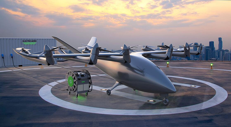
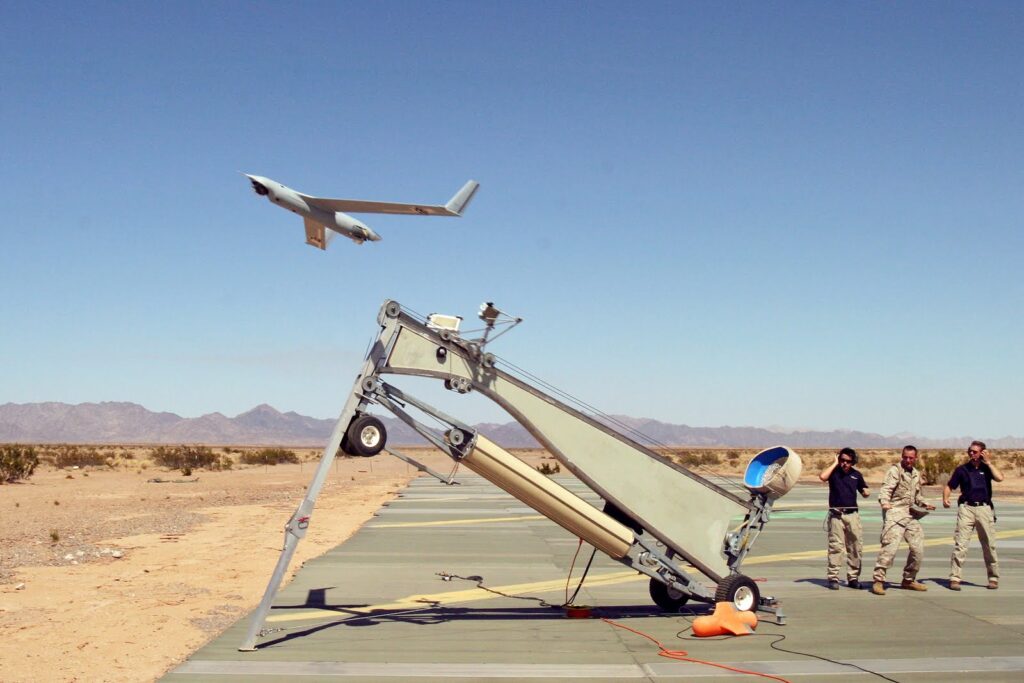
(Photo: Electro.Aero)

Le Bris also discussed other factors to consider, such as energy requirements, power infrastructure, energy resiliency, and the potential use of hydrogen as a power source for fuel-cell electric aircraft. Developing specific supply chains to deliver hydrogen to aviation end-users is a critical consideration in realizing the full potential of these technologies.

By considering different scenarios, addressing uncertainties, and strategically planning infrastructure development, airports can successfully integrate electric aircraft into their operations and capitalize on the promise of advanced air mobility.

During the interview, Le Bris shared insights on how states like Washington, Utah, and North Carolina are actively preparing for the implementation of electric aircraft operations. He highlighted WSP’s involvement in helping these states develop a vision and strategy to facilitate the emergence of these technologies while leveraging them for the benefit of communities.

In the case of Washington State, WSP conducted an electric aviation implementation study to assess different use cases and determine an implementation timeline. The study aimed to identify early policies and programs that would position Washington State at the forefront of electric aviation. Given the presence of OEMs and flight operators in the state, it was crucial to develop strategies that align with their progress.

Similarly, the State of Utah engaged WSP in an AAM implementation study. Beyond timelines and technologies, the study focused on planning policies to direct positive energy around AAM and create services that serve specific use cases and communities throughout the state. Le Bris emphasized the importance of safe and efficient facilities to support the emerging AAM industry.

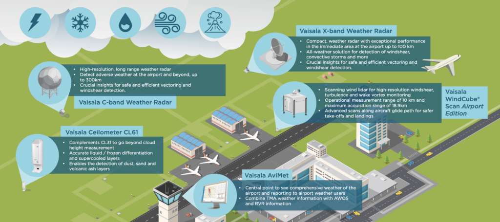
One specific aspect explored with the state of Utah was the possibility of state departments of transportation (DOTs) issuing minimum standards for vertiport facilities. Currently, there is no federal standard for vertiports, and relevant documents, such as the FAA’s Engineering Brief 105, are at varying stages of maturity. WSP aimed to consolidate existing guidance and provide suggestions on things like vertiport design, power requirements, building codes, aircraft detection, monitoring equipment, and micro weather systems.

Le Bris also referred to a previous engagement with the North Carolina Department of Transportation (DOT) on the development of NC Move 2050. This long-range vision aimed to combine ground, air, and sea transportation across the state. WSP contributed expertise to help North Carolina envision corridors and routes for small uncrewed aircraft systems (UAS) delivery, urban air mobility, and other emerging transportation modes.

Will electric aircraft such as eVTOLs be able to compete with ride-sharing services like Uber and Lyft? Rather than competing directly, these kinds of passenger services will actually be complementary, according to Le Bris.

He noted that advanced air mobility (AAM) and mass transit offer distinct forms of transportation and serve different purposes within communities.

Le Bris dismissed the notion that AAM would replace mass transit entirely, highlighting that both play vital roles in meeting diverse mobility needs. Mass transit provides efficient transportation for large numbers of people, while AAM offers local aviation capabilities. The pricing and speed of these services differ significantly, and customers should not expect the cost of an eVTOL ride, particularly one that requires a pilot, to be as affordable as a bus ticket or commuter train ride.

While the price of an eVTOL ride may be higher than traditional transportation options, flying above congested traffic offers a unique value proposition. As an example, Le Bris cited Blade Air Mobility’s operation of conventional helicopters from Manhattan to airports in the New York area, with an airfare price of around $120. If AAM can offer a similar pricing range or even slightly lower costs due to reduced operating expenses, “I think we’re opening a lot of doors here to regular middle-class people being able to afford these things for going to the airport,” he remarked.

In the future, AAM could be even more affordable as a result of automation.
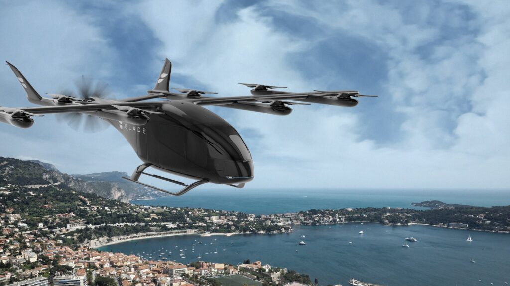
(Photo: Blade)

Earlier this year, Blade Air Mobility and BETA Technologies completed the first test flight of a piloted eVTOL aircraft in the greater New York City area.

One critical factor affecting the cost dynamics of AAM is aircraft certification. Regulatory bodies are adjusting their certification approaches for these innovative aircraft, and their requirements will have a substantial influence on overall costs. Le Bris emphasized that the evolving certification process will shape the future economic landscape of electric aircraft and their competitiveness with traditional taxi services.

Extensive collaboration among stakeholders and regulators is needed in order to realize the full potential of advanced air mobility. There is a need to establish appropriate standards and industry practices while ensuring a realistic and reasonable timeline for implementation. 

Le Bris stressed the significance of an inclusive approach that actively engages local communities, particularly when creating new services for intra-city and intra-urban mobility. To successfully develop vertiports and transform existing heliports into efficient operations facilities, obtaining the support and buy-in of the local community is essential. This collaborative construction of the future of advanced mobility should involve residents and various stakeholders to ensure that their perspectives are considered and valued.

Read more about WSP’s perspective on electric aviation here.

—————
Boost Internet Speed
Free Business Hosting
Free Email Account
Dropcatch
Free Secure Email
Secure Email
Cheap VOIP Calls
Free Hosting
Boost Inflight Wifi
Premium Domains
Free Domains

NASA’s Artemis II Rocket Flight Software Meets Testing Checkpoint

Software engineers recently finished the first part of the Artemis II SLS flight software’s formal qualification testing. (Photos: NASA/Brandon Hancock)

As NASA’s Artemis program progresses, its team is reaching significant milestones. The first Artemis astronauts have commenced their training for the landmark Artemis II mission, which will orbit the Moon. Meanwhile, at NASA’s Marshall Space Flight Center in Huntsville, Alabama, dedicated teams are testing and configuring the flight software that will power the large Moon rocket on its journey.

The initial training phase for the key members of the Artemis II mission is well underway. At the heart of the mission lies the Space Launch System (SLS), NASA’s most powerful rocket. When the SLS launches the Artemis II crew aboard the Orion spacecraft, the rocket will generate 8.8 million pounds of thrust. The flight software of the SLS acts as the “brains” of the rocket, orchestrating its complex operations from ignition until the separation of the in-space propulsion stage, all transpiring within the critical first eight minutes of the mission.

Inside the state-of-the-art SLS Software Development Facility (SDF) at the Marshall Space Flight Center, a team of skilled software engineers recently completed the initial phase of formal qualification testing for the Artemis II SLS flight software. This software, consisting of approximately 50,000 lines of code, has undergone rigorous testing to ensure its reliability and efficiency.

The testing process involves simulating various normal and off-nominal SLS rocket and environmental scenarios, known as test cases, to assess the performance of the SLS computer systems and flight software. The engineers executed 179 procedures, comprising approximately 58,000 test cases, during the two-week test period, surpassing the scope of the previous qualification testing conducted for Artemis II in 2022.

Building on the success of the Artemis I launch in November 2022, the SLS flight software team has incorporated operational enhancements and novel test scenarios into the Artemis II preparations. Valuable lessons learned from previous missions have influenced the development of the software, ensuring that it is primed to respond effectively to thousands of potential test cases on launch day.

The upcoming months will witness the commencement of the second and final phase of formal qualification testing for the SLS flight software in the SDF, scheduled to begin in July. Engineers will initiate integrated system testing in the SLS System Integration Lab (SIL) using the complete suite of SLS avionics hardware and flight software, starting in the fall. The comprehensive results obtained from the SIL system and the flight software SDF will provide essential evidence to support the readiness of the Artemis II mission.

By the time Artemis II embarks on its journey, the flight software engineers will have virtually “flown” the SLS mission more than 100,000 times within the extensive SLS avionics and software development and test facilities.

—————
Boost Internet Speed
Free Business Hosting
Free Email Account
Dropcatch
Free Secure Email
Secure Email
Cheap VOIP Calls
Free Hosting
Boost Inflight Wifi
Premium Domains
Free Domains

Honeywell to Acquire Saab’s Heads-Up Display Assets

A new agreement includes plans for a three-year collaboration between Saab and Honeywell; the Head-Up Display (HUD) assets will be transferred to Honeywell following the collaboration. (Photo: Saab)

Honeywell and Swedish aerospace and defense company Saab reached an agreement last week regarding the acquisition of Saab’s heads-up display (HUD) assets. The HUDs will be integrated into the Honeywell Anthem flight deck (following a three-year collaboration) and will be available as an option for Honeywell’s Primus Epic flight deck as well.

Vipul Gupta, vice president and general manager, Avionics, Honeywell Aerospace, remarked in the company’s announcement that HUDs can improve situational awareness for pilots and reduce their workload. They also improve airport access as part of an Enhanced Flight Vision System. “The addition of HUDs as part of our wider avionics offerings will provide our customers in business aviation, air transport, and defense segment a great safety tool that can be particularly useful during takeoff and landing, which are typically the most crucial parts of any flight,” Gupta said.

(Photo: Saab)

HUD technology has evolved significantly since its early days and has become an integral part of aviation operations. Leading companies like Honeywell, Collins Aerospace, Thales, and Elbit Systems continue to push the boundaries of HUD development, resulting in advanced systems that enhance pilot situational awareness and safety. With continued advancements in display technology, augmented reality, and integration with other avionics systems, the future of HUDs holds tremendous potential for revolutionizing the aviation industry further.

Thales first introduced the initial version of TopMax, a wearable HUD, in 2016. An upgraded version of the technology was unveiled in 2019 as a lighter, less bulky headset.

(Thales)

Elbit Systems designed a Low-Profile Head-Up Display (LPHUD) series for advanced fighter jets that includes a range of narrow neck HUD systems. The LPHUDs are compatible with advanced 4th, 4.5, and 5th-generation fighter aircraft, and they feature a Large Area Display (LAD). 

(Photo: Elbit)

Last October, Collins achieved a technical standard order, or TSO, for its combined vision system (CVS) for business aviation aircraft. Their “advanced CVS algorithms blend the full EVS image and SVS into a single conformal view,” according to the company.

“Whether it’s poor weather, smoke, dust, demanding terrain or busy airports, CVS clearly and automatically displays the critical visual information pilots need to safely operate their aircraft,” explained Craig Brown, general manager of Vision Systems at Collins.

(Collins)

The concept of the heads-up display was first introduced for military aircraft during World War II. These early systems consisted of basic optical components that projected simple targeting information onto a transparent screen.

HUD technology eventually found its way into civil aviation cockpits. In the 1970s, the first commercial aircraft to adopt HUDs was the General Dynamics F-111B. However, it was the introduction of the Rockwell Collins (now Collins Aerospace) HUD system in the Boeing 767 that marked a significant milestone for HUD technology in the commercial aviation sector. This development prompted further integration into various aircraft models.

Over the years, some notable advancements in HUD technology have been made:

Augmented Reality (AR) HUDs: AR HUDs have revolutionized the aviation industry by overlaying digital information on the real-world view. These systems provide pilots with real-time data, like navigation cues, flight parameters, and weather conditions, superimposed directly onto their field of view.

Enhanced Display Capabilities: HUDs now offer high-resolution, color displays with wider fields of view, ensuring better readability and improved situational awareness for pilots. These advancements enable pilots to quickly interpret critical information without diverting their attention from the external environment.

Integration with Synthetic Vision Systems (SVS): The integration of HUDs with SVS technology has been instrumental in enhancing pilot situational awareness during low-visibility conditions. By combining real-time sensor data and digital terrain databases, pilots are provided with a virtual representation of the external environment, reducing the risk of controlled flight into terrain (CFIT) accidents.

Head-Wearable Displays (HWDs): Recent developments in HWDs, such as smart glasses, offer potential HUD applications in general aviation. These wearable devices can provide pilots with critical flight data and navigation information while maintaining a clear line of sight outside the cockpit.

—————
Boost Internet Speed
Free Business Hosting
Free Email Account
Dropcatch
Free Secure Email
Secure Email
Cheap VOIP Calls
Free Hosting
Boost Inflight Wifi
Premium Domains
Free Domains

Inside the FLARM Collision Avoidance System

(Photos: FLARM)

FLARM (FLight alARM), a traffic and collision avoidance system developed by the company of the same name, is helping pilots to avoid collisions by bolstering their situational awareness. With several aircraft across the world now equipped with this technology, Flarm Technology hopes its collision avoidance system will help maintain the aviation industry’s strong safety record.

FLARM mitigates the risk of in-flight collisions by calculating and sharing an aircraft’s future flight paths with other nearby aircraft all while collecting the same data from surrounding air traffic. Then, using an intelligent motion prediction algorithm, FLARM calculates the collision risk for an aircraft based on an integrated risk model. The system works even in areas with limited radar coverage.

Most FLARM systems incorporate an ADS-B and transponder receiver which incorporates transponder-equipped aircraft into the collision prediction algorithm, the company says. This is particularly important for operations in high-density traffic airspace.

The most recent aircraft to receive this technology is the Bell 214 helicopter. The two-bladed rotorcraft, which was built between 1970 and 1981, has a service ceiling of 16,400 feet and a range of 220 nautical miles. The helicopter has a cruise speed of 140 knots and a length of just under 50 feet. These specifications have made it a popular choice for military and air rescue operations, both sectors of the aviation industry in which a strong collision avoidance system is not only useful, but also a potentially life-saving feature.

When installed by SPAES Aviation, two FLARM antennas were strategically placed on the helicopter to maximize both transmission and signal reception. Equipping the helicopter with FLARM also required integrating the system’s avionics with the existing avionics suite of the Bell 214. Thanks to close collaboration with the customer, SPAES reported that the integration of FLARM with the aircraft’s existing systems and interfaces was a seamless process. Following its installation, SPAES performed extensive testing to validate the performance and functionality of the system, and the results showed that FLARM met the highest industry standards and regulations.

FLARM calculates and broadcasts its future flight path to nearby aircraft. It also receives future flight paths from any nearby aircraft. An algorithm calculates a predicted risk of collision for each aircraft, and pilots are alerted when a collision is imminent.

Operators using FLARM will enjoy several benefits that enhance the safety of flight, the company says. For one, pilots will experience improved situational awareness thanks to the ability to detect nearby traffic, even in low visibility and non-optimal weather conditions. The system also provides visual and audio alerts to pilots, thus helping to ensure that collisions are avoided by allowing pilots to take evasive actions in a timely manner.

“Installing the FLARM collision avoidance system in the Bell 214 helicopter not only elevates safety measures but also instills confidence and reassurance among pilots and operators,” said Joachim Schanz, CEO of SPAES Aviation.

This system is compatible with a variety of aircraft types extending well beyond the Bell 214, FLARM says. Several variations of the system were created to give customers more flexible options when installing FLARM. For example, PowerFLARM Portable was created for aircraft where behind-the-panel installation isn’t possible. With variations accommodating a variety of aircraft designs, FLARM hopes its system will prove to be popular across many industry segments and aircraft types.

While SPAES Aviation installed FLARM on the Bell 214, it offers a variety of products and services that support aircraft operations for customers. The aerospace company dedicates much of its efforts to the development of mission equipment and creating features that help crews in challenging situations and conditions. Its range of avionics services in this area includes entertainment, flight management, GPS, WHEEL ALT, data recording, TCAS, and COM/NAV.

SPAES is a standalone Part 21J design organization and Part 21G production organization. The company has European-wide access to several aviation companies and maintenance organizations.

The company also develops medical systems to support air-rescue crews. Oftentimes these crews are faced with patients in life-threatening conditions, meaning having optimal medical equipment installed on aircraft can save lives. Additionally, SPAES supports firms in engineering projects. For years it has worked with customers to help develop and approve new aviation technologies. The development of aircraft structural components and integration of tactical systems are just two examples of how it helps customers reach their goals through project support, and how it supported customers while integrating FLARM with the Bell 214’s existing systems.

FLARM is one of the partners involved in Switzerland’s U-space Implementation (SUSI). The Swiss U-space Implementation framework was designed by the Federal Office of Civil Aviation (FOCA) to build an open ecosystem for uncrewed traffic management, or UTM, in Switzerland. FLARM is working on electronic identification for uncrewed aircraft systems (UAS). Regulations have started to require UAS to be identified remotely by electronic means, which is done in combination with a UAS registry database. This improves security and provides easier access to airspace for operators.

The principle of electronic identification (eID) is that a cooperative UAS regularly broadcasts a unique identifier and the current position through a radio frequency digital message. This enables authorized parties to detect, identify, locate, and track UAS anywhere at any time, also in the absence of network connectivity or other infrastructure.

SPAES Aviation’s latest project of installing FLARM on the Bell 214 helicopter demonstrates its dedication to helping customers modernize their fleets and operations with better technology. With more aircraft taking to the skies than ever before, modern collision avoidance solutions will be critical to maintaining safety in the aviation industry. 

—————
Boost Internet Speed
Free Business Hosting
Free Email Account
Dropcatch
Free Secure Email
Secure Email
Cheap VOIP Calls
Free Hosting
Boost Inflight Wifi
Premium Domains
Free Domains

Coast Guard Issues Draft RFP For Maritime UAS

The U.S. Coast Guard (USCG) issued a draft RFP for industry comment for maritime UAS for some of its fleet. (Photo: U.S. Marine Corps/Sgt Guadalupe M. Deanda III)

The Coast Guard last week issued a draft request for proposal (RFP) for unmanned aircraft systems (UAS) that would be operated by contractors aboard some of its cutters, moving a step closer toward a new procurement.

The draft solicitation is for Group II and III UAS, the former having a gross take-off weight between 21 and 55 pounds and the latter weighing less than 1,320 pounds. Currently, the Coast Guard’s high-endurance national security cutters (NSCs) operate with Group II ScanEagle drones, which are owned and operated by Insitu, a unit of Boeing.

The contract with Insitu will soon be ending and the draft RFP will be for continuing a contractor-owned, contractor-operated capability aboard the NSCs, a Coast Guard spokeswoman told Defense Daily on Wednesday.

Insitu formed a partnership in 2021 with two Norwegian companies, Robot Aviation and Andøya Space, to build an uncrewed aviation ecosystem for the Arctic and High North. At the time, the Insitu ScanEagle UAS had flown more than 1.3 million hours.

Previously, the Coast Guard issued two requests for information to help inform requirements for the pending maritime UAS (MUAS) procurement. In addition to the NSCs, the Coast Guard plans to eventually deploy UAS aboard its medium endurance offshore patrol cutters as they come online.

Some of the performance objectives of the MUAS services outlined in the draft RFP include tracing a wide range of targets to include go-fast boats, small wooden boats, self-propelled semi-submersibles, and persons in the water for at least 12 continuous flight hours per day, as well as to be able to do conduct multi-day surge operations that exceed 12 hours of continuous intelligence, surveillance, and reconnaissance flight time for up to five straight days. The MUAS will also support other units with imagery, data, target illumination, communication relay, or other capabilities.

This article was originally published by Defense Daily, a sister publication of Avionics International. It has been edited. Read the original version here >>

—————
Boost Internet Speed
Free Business Hosting
Free Email Account
Dropcatch
Free Secure Email
Secure Email
Cheap VOIP Calls
Free Hosting
Boost Inflight Wifi
Premium Domains
Free Domains

Improving Efficiency for Airlines with Weather Sensing Technology

Aleksis Kajava of Vaisala highlights the importance of monitoring weather conditions in the Terminal Maneuvering Area (TMA). Pictured above is a plane landing in a crosswind at Leeds Airport. (Photo credit: Chris Procter)

Efficiency and safety are paramount in the fast-paced world of aviation. Weather conditions play a crucial role in flight operations, often causing delays, rerouting, and increased fuel consumption. To address these challenges, Vaisala, a leader in weather awareness technology, is harnessing the power of remote sensing to enhance weather observations and build a more sustainable future for aviation.

The Terminal Maneuvering Area (TMA) is the busiest part of flight operations, where weather-related incidents and delays frequently occur. While regulatory Automated Weather Observing Systems (AWOS) cover the airport area, they do not extend to the TMA, leaving critical gaps in weather awareness. These gaps can result in suboptimal flight approaches or departures, landing difficulties, and increased emissions.

Vaisala’s approach goes beyond airport boundaries by utilizing various remote sensing technologies, including radar, wind LiDAR, lightning detection, and decision support software. This combination enables total weather awareness and high-resolution nowcasting in the TMA, enabling safety and efficiency. These advancements are particularly significant in an industry grappling with environmental concerns.

In a recent interview with Avionics International, Aleksis Kajava, Sales Director of Weather and Environment for Europe and Latin America at Vaisala, emphasized the importance of enhancing weather observations in the TMA. The company’s state-of-the-art remote sensing equipment enables monitoring of storms, lightning, precipitation, winds, icing, and various severe weather conditions not only at the airport but also around it. By providing such comprehensive data, Vaisala’s solutions benefit airlines such as Saudia by improving flight safety and efficiency, ultimately contributing to the sustainability of aviation.

Aleksis Kajava, Sales Director, Weather and Environment, Europe and Latin America (Vaisala)

“At the end of the day, it’s about the end user, but of course, the air traffic controller is the intermediary there,” Kajava remarked.

Fuel efficiency is a critical aspect of sustainability in aviation. Accurate weather information in the TMA allows aircraft to avoid adverse weather conditions such as turbulence and storms, which might necessitate deviations from flight plans. By equipping airlines and air traffic control with precise information, unnecessary fuel burn due to rerouting to alternative airports can be prevented. Similarly, avoiding long delays in departure reduces fuel consumption. Safety is another vital factor—making the right decisions, such as rerouting or holding aircraft, helps prevent accidents and equipment damage. By enhancing safety, Vaisala’s technology contributes to overall sustainability in the aviation industry.

“Radar, lidar, lightning detection, and decision support software combine for total weather awareness and high-resolution nowcasting.” (Vaisala)

“You may be able to avoid directing flights to holding patterns and burning fuel while in the holding or circling pattern,” said Kajava. “Sometimes you need to make tough decisions like putting the aircraft in a holding pattern or asking the pilot to do another landing to ensure the safety of the flight.”

Noise reduction is an additional benefit derived from accurate weather information. Temperature inversions, wind patterns, and other conditions impact aircraft noise levels. By optimizing runway selection and flight paths based on precise weather data, Vaisala’s technology allows customers to minimize the noise impact on nearby communities, thereby mitigating noise pollution.

(Photo: Shutterstock / Samuel Acosta)

Regarding recent technological advancements, Kajava highlighted several innovations developed by Vaisala. One is a new version of their laser-based wind measurement equipment, capable of three-dimensional wind measurements within a 10-kilometer range around the airport. The company has also introduced an enhanced weather radar specifically designed for measuring severe conditions in airport surroundings. Furthermore, a new family of ceilometers has been developed, enabling the measurement of icing conditions during approaches. Vaisala’s continuous improvements also extend to the user interface, ensuring enhanced data visualization.

Recently launched, Vaisala’s humidity profiler measures the humidity of the atmosphere, which significantly improves short-term weather forecasting around airports. While the humidity profile itself may not be highly relevant, Kajava explained that the enhanced short-term forecasts resulting from this technology significantly benefit thunderstorm weather forecasting. Vaisala collaborates with specialized partners in aviation weather forecasting to explore new tools and applications that leverage this equipment for more precise short-term forecasts.

The newest addition to Vaisala’s family of solid-state radars is the WRS300. (Photo: Vaisala)

Vaisala’s strategic priorities revolve around continuous technology improvement for monitoring weather using remote sensing equipment. The company works closely with internal and external stakeholders to provide operational decision-making information in the most useful format for aviation users. We are helping our customers not just to buy the technology but also to leverage it,” Kajava added.

Vaisala’s equipment is deployed in over 2,000 medium and large-sized airports worldwide. With a presence in 170 countries, the company’s impact on weather monitoring is extensive. Headquartered in Finland, Vaisala has a workforce of over 2,000 employees. 

While the development of advanced air mobility (AAM) aircraft like drones and air taxis is being pitched as an advancement of logistical support to move cargo and people, a project from university researchers and NASA could allow these aircraft to create more accurate weather predictions.

Researchers at Oklahoma State University have received funding from NASA to improve real-time forecasting of low-level winds and turbulence. This research project, which started in 2020, aims to ensure operational safety for drones in urban and rural environments.

—————
Boost Internet Speed
Free Business Hosting
Free Email Account
Dropcatch
Free Secure Email
Secure Email
Cheap VOIP Calls
Free Hosting
Boost Inflight Wifi
Premium Domains
Free Domains

OneWeb Expands Service Across Europe and US

OneWeb started services in 37 new countries in Europe including Austria, Italy, France, and Portugal at the end of May. (Photo: OneWeb)

OneWeb has initiated service across Europe and much of the United States as the Low-Earth Orbit (LEO) constellation is working toward global service.

The satellite operator announced on Wednesday that it started service at the end of May in 37 new countries in Europe including Austria, Italy, France, and Portugal, and the West Coast of the U.S.—from Washington to California—as well as the Northeast coast, from Maine to Virginia, and across the Midwest. OneWeb is now reaching regions above the latitude of 35 degrees north.

OneWeb is the second LEO constellation in operation after SpaceX’s Starlink, with 634 satellites. OneWeb’s business model is as a wholesale connectivity provider, working with telecommunications companies and internet service providers that integrate the OneWeb service into their connectivity services. Starlink started out as a direct-to-consumer operation, but Starlink now also does deals with service providers and enterprises like cruise lines and airlines.

OneWeb’s Chief Customer Officer Stephen Beynon said this service supports existing partners and is welcoming new partners as well.

“This expansion is a significant step in our journey to delivering global commercial service for our customers. We are seeing increased demand for our service as we have expanded coverage and grown our portfolio of user terminals for different markets,” Benyon commented. “As our network coverage continues to grow, I am incredibly excited to serve more maritime, government, enterprise, and aviation customers.”

In December 2022, SpaceX performed its first mission for OneWeb, sending 40 satellites to Low-Earth Orbit (LEO) on a Falcon 9 rocket. The rocket took off from NASA’s Kennedy Space Center in Cape Canaveral, Florida, on Dec. 8, bringing OneWeb’s constellation to 502 satellites at the time.

This article was originally published by Via Satellite, a sister publication to Avionics International. Click here to read the original version >>

—————
Boost Internet Speed
Free Business Hosting
Free Email Account
Dropcatch
Free Secure Email
Secure Email
Cheap VOIP Calls
Free Hosting
Boost Inflight Wifi
Premium Domains
Free Domains

NASA Signs Unfunded Collaborations With Blue Origin, SpaceX, Northrop Grumman, and Others on Commercial LEO Projects

A 3D render of Earth viewed from space (Photo: NASA)

NASA announced unfunded Space Act agreements with seven companies on projects related to human spaceflight and the commercial Low Earth Orbit (LEO) economy. SpaceXBlue OriginNorthrop GrummanSpecial Aerospace ServicesThinkOrbital, and Vast signed agreements with NASA.

This is NASA’s second Collaboration for Commercial Space Capabilities-2 initiative (CCSC-2). NASA shares technical expertise, assessments, technologies, and data, with the companies involved.

SpaceX is collaborating with NASA on potentially using Starship as both transportation and a destination in LEO, and an integrated LEO architecture of SpaceX’s portfolio including Super Heavy, Dragon, and Starlink.

Blue Origin’s agreement involves developing commercial space transportation with high-frequency U.S. access to orbit for crew and other missions.

Northrop Grumman is working with NASA on its Persistent Platform for autonomous and robotic capabilities for commercial science research and manufacturing capabilities in LEO.

The Special Aerospace Services agreement looks at in-space servicing technology to assemble and service commercial Low-Earth Orbit destinations. ThinkOrbital is collaborating with NASA on its development of ThinkPlatforms that can be used for a variety of applications in LEO, and CONTESA (Construction Technologies for Space Applications). And Vast’s agreement deals with technologies for its microgravity and artificial gravity stations.

NASA said these agreements will foster more competition for future services.

“It is great to see companies invest their own capital toward innovative commercial space capabilities, and we’ve seen how these types of partnerships benefit both the private sector and NASA,” said Phil McAlister, director of commercial spaceflight at NASA Headquarters in Washington, D.C. “The companies can leverage NASA’s vast knowledge and experience, and the agency can be a customer for the capabilities included in the agreements in the future.”

This article was originally published by Via Satellite, a sister publication to Avionics International. Click here to read the original version >>

—————
Boost Internet Speed
Free Business Hosting
Free Email Account
Dropcatch
Free Secure Email
Secure Email
Cheap VOIP Calls
Free Hosting
Boost Inflight Wifi
Premium Domains
Free Domains

Embraer Launches New Predictive Maintenance System for Executive Jets

Embraer recently launched the next generation of the AHEAD tool for airlines and other customers to implement digital predictive maintenance on E-Jets. (Photos: Embraer)

Embraer Services & Support has launched a next-generation version of its Aircraft Health Analysis and Diagnosis (AHEAD) system, which can help airlines and other customers monitor their aircraft for potential maintenance issues before they break or present critical problems. 

Announced at the Paris Air Show last week, AHEAD provides digital predictive maintenance for Embraer’s Executive Jet (also called E-Jet) fleets. More than 1,250 commercial and executive Embraer aircraft are using AHEAD worldwide.

Predictive maintenance, backed by increasingly advanced health and usage monitoring systems integrated into flight-critical aircraft systems, is overtaking reactive maintenance as the industry norm, as Avionics explored in depth in this previous feature

Using data analysis to detect operational anomalies and possible defects allows operators to fix problems or replace parts before they cause time-consuming, costly, and potentially catastrophic component failures.

“AHEAD uses predictive analytics solutions to forecast when maintenance tasks will be needed by our customers, allowing them to plan maintenance schedules in advance.” (Embraer)

Most modern aircraft broadcast detailed data from sensors arrayed throughout the airframe, which is then analyzed through health and usage monitoring systems, or HUMS. Systems such as AHEAD make data-gathering and analysis much easier for aircraft maintenance shops.

AHEAD integrates and analyzes trends from several systems such as engine parameters, pneumatics, hydraulics, landing gear, navigation, and instruments, Embraer said. The monitoring can detect anomalies and identify patterns that indicate potential issues and systems degradation and prescribe a timeline for addressing those issues.

The system’s new version was developed using the expertise of Embraer Services & Support engineering which has 20 years of experience doing aircraft data analysis for predictive maintenance of E-Jet fleets. 

Embraer used that experience to implement 12 new reliability trends for aircraft systems for early degradation detection on E2, predictive capabilities powered by machine learning, and troubleshooting enhancement for Flight Controls No Dispatch.

“AHEAD uses predictive analytics solutions to forecast when maintenance tasks will be needed by our customers, allowing them to plan maintenance schedules in advance. By planning in advance, they can avoid unnecessary maintenance and reduce the time that aircraft spend on the ground. This helps our customers optimize their resources and improve operational efficiency,” says Johann Bordais, President and CEO, Embraer Services & Support.

Embraer Services & Support plans to release a new update soon that will contain more reliability trends and tailored maintenance recommendations in real-time, the company said.

—————
Boost Internet Speed
Free Business Hosting
Free Email Account
Dropcatch
Free Secure Email
Secure Email
Cheap VOIP Calls
Free Hosting
Boost Inflight Wifi
Premium Domains
Free Domains

Airbus Coordinates Several European Defence Fund Projects

On June 26, the European Commission announced plans to fund 41 collaborative defense research and development projects with a budget totaling €832 million (about $904 million USD). Airbus is participating in 10 of these projects, funded as part of the European Defence Fund. (Photo: European Commission)

European aircraft manufacturer Airbus will be participating in 10 projects focused on defense research and development that are funded by the European Commission through its European Defence Fund (EDF). These projects focus on several aspects of aviation and defense, and Airbus’ expertise and extensive resources in the field will help fuel innovation in the sector. Of the 10 projects, Airbus will coordinate four of them.

The European Commission first announced plans to fund 41 research and development projects focused on defense on June 26, 2023. The EDF’s collective support for these programs totaled  €832 million. The funding is a response to a call for proposals issued last year, and these EDF proposals will help develop high-end defense capability projects in areas like naval, air, cybersecurity, and space.

Through the funding of projects like this, the European Union will maintain security and strong defense systems and resources. As Mike Schoellhorn, CEO of Airbus Defense and Space, explained, “In times where individual nations are protective of their respective national champions, European collaboration is more important than ever to create much-needed scale for defense in Europe. I thank the European Commission for their relentless drive to push cooperation among member states.”

While contributing to 10 projects funded by the European Defence Fund, Airbus will coordinate four of them: the Single European Sky and Interoperability, European Cyber and Information Warfare Toolbox, a Future Air System for European Tactical Transportation, and the space-based Persistent ISR for Defense and Europe Reinforcement.

The Single European Sky is a major attempt to de-fragment European airspace, all while reducing delays, improving safety and flight efficiency, and reducing aviation’s carbon footprint. Europe is a massive aviation market across all sectors, from commercial to private to defense—meaning that the current European Air Traffic Management (ATM) system controls well over 27,000 flights on a daily basis. Despite these impressive volumes, each flight is on average 49 kilometers longer than the direct route, indicating serious inefficiencies in current technology. In fact, the estimated yearly cost of this fragmentation is €4 billion. Therefore, addressing this challenge could result in lower costs for operators and fewer environmental impacts overall.

The next major project that Airbus will coordinate is focused on cybersecurity. The safety of sensitive information stored online is critical to national security. As the European Commission explains, “The continuously and rapidly increasing flow of information in the information environment, facilitated through cyber capabilities, is a well-established fact. We are witnessing an increasing number of malicious actions targeting the information environment.” Facing such challenges, this project will develop technological infrastructure designed to detect threats and deliver countermeasures to keep confidential data safe.

Future Air System for European Tactical Transportation (FASETT) is the third major project Airbus will coordinate. As a part of the EDF’s support for this project, a consortium of developers (including DE Avio, ITP, Aero Engines, Safran, and Rolls Royce Deutschland) led by Airbus’ Defense and Space branch will be granted €30 million to conduct a feasibility study for a brand-new tactical transport aircraft. Planned to last for about 18 months, the study will mainly analyze EU member nations and their needs for new transport aircraft in the 2030s and 2040s. Several of the countries contributing to FASETT—France, Germany, Spain, and Sweden—are also involved in PESCO, a similar project aiming to develop a new military transport aircraft.

The last project Airbus will lead in collaboration with the European Commission is the Space-based Persistent ISR for Defense and Europe Reinforcement (SPIDER). Behind this project is a variety of aerospace companies that span across many of the European Union’s member countries: Aalborg University (Denmark), DATI Group SIA (Latvia), E-GEOS SpA (Italy), Leonardo SpA (Italy), SAFRAN DATA SYSTEMS (France), and many more. The goal of SPIDER is to conduct a feasibility study regarding the development of multi-mission affordable satellite constellations. These would be dedicated to space-based Intelligence/Surveillance/Reconnaissance (ISR) for use by defense agencies. As a result of the study, the consortium behind the project plans to have both a preliminary system design and cost analysis completed.

The European Commission has funded these projects in an attempt to maintain national security for member states while modernizing the infrastructure defense agencies currently use to protect civilians. Given Airbus’ extensive knowledge and resources in the defense sector, it can coordinate vast amounts of research and development alongside other consortium members to help accomplish the European Commission’s goals.

—————
Boost Internet Speed
Free Business Hosting
Free Email Account
Dropcatch
Free Secure Email
Secure Email
Cheap VOIP Calls
Free Hosting
Boost Inflight Wifi
Premium Domains
Free Domains