Search for:

Researchers Develop AI Pilot for Navigating Crowded Airspace

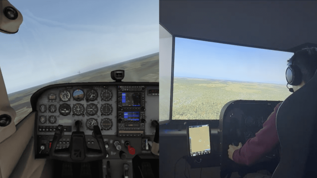
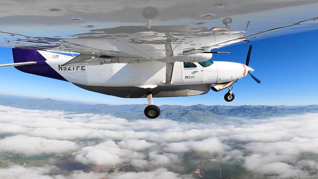
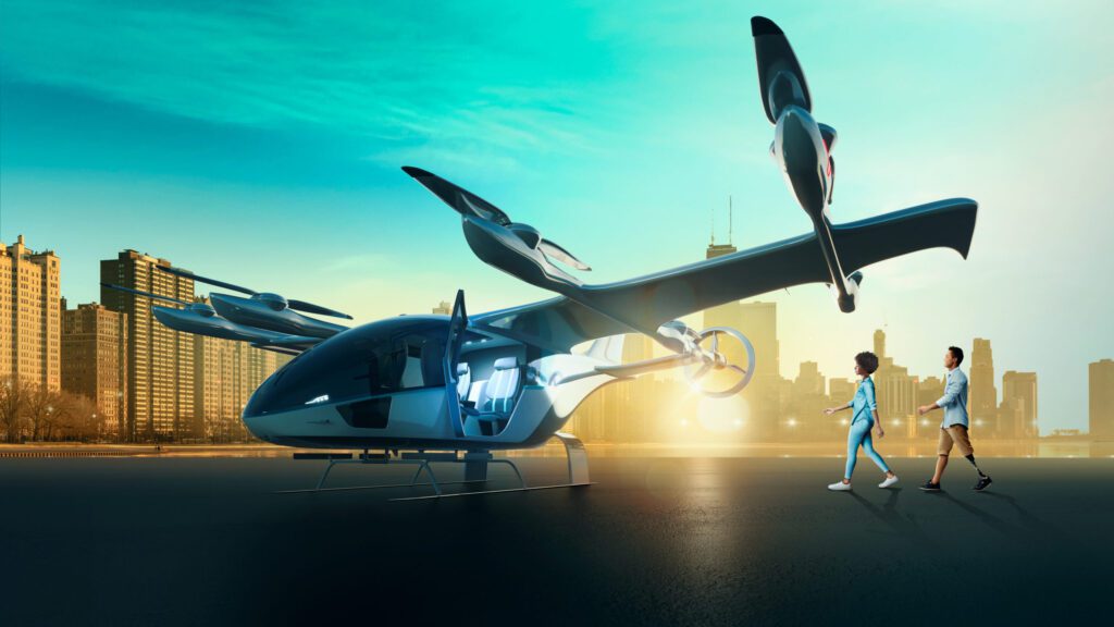
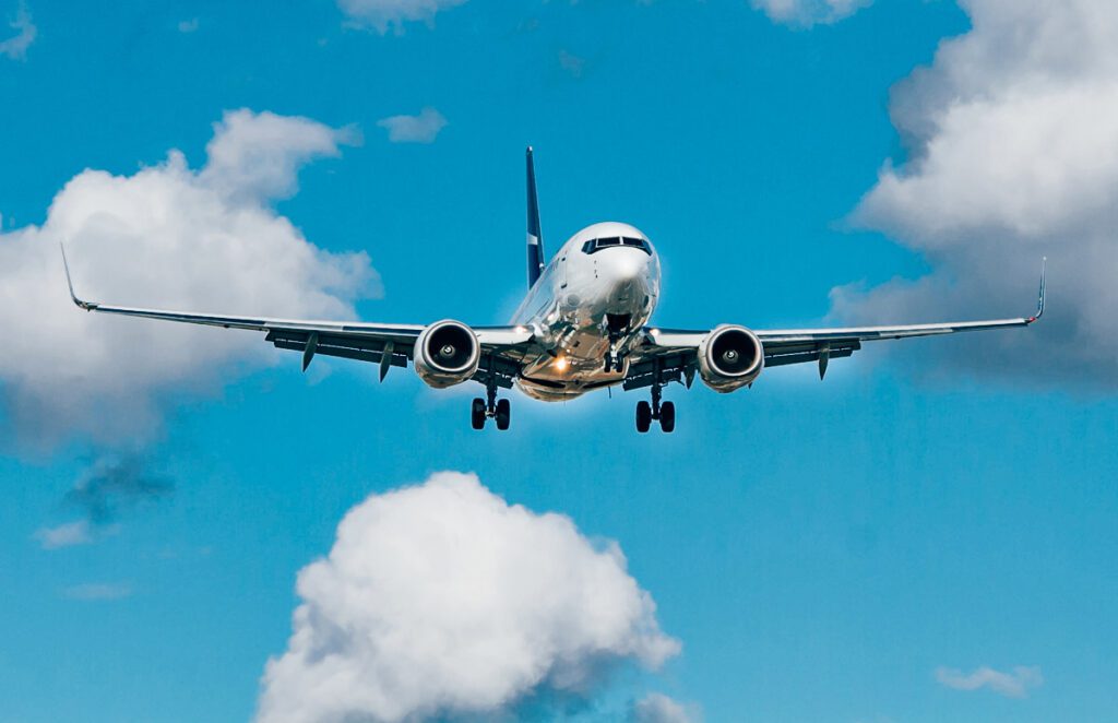
New research from the Robotics Institute at Carnegie Mellon University shows that AI-powered pilots could enable the integration of autonomous aircraft into the airspace. Above is a simulation demonstrating the capabilities of an AI pilot. (Photo: The Robotics Institute, Carnegie Mellon University)

Researchers at Carnegie Mellon University have designed an AI (artificial intelligence) pilot that can navigate an aircraft through crowded airspace using visual flight rules (VFR). The AI pilot has been tested on flight simulators, and it detects other aircraft using a computer vision system and six cameras. It also offers the ability to communicate with air traffic controllers and pilots using its automatic speech recognition function.

There has not been sufficient research conducted on integrating autonomous vehicles into the airspace with manned aircraft, according to Jay Patrikar, a Ph.D. student at Carnegie Mellon’s Robotics Institute that worked on the AI pilot project.

“With air taxis, most have been focusing on the hardware—building the aircraft, making it go faster and farther,” Patrikar told Avionics International. “Nobody has talked enough about how these taxis would get integrated into the current airspace system.” 

The AI pilot can operate an aircraft just like a human pilot, shared Dr. Jean Oh, associate research professor at the university’s Robotics Institute. She noted that larger airports usually have an air traffic control tower to optimize the schedule for aircraft taking off and landing.

At smaller airports, pilots rely on radio communications and visually observing other aircraft in the airspace to coordinate their actions. According to the Carnegie Melon team, most autopilot controls featured in commercial airliners and other aircraft are designed to operate under instrument flight rules (IFRs). That’s one reason why their team is focused on developing an AI pilot that can interact with other aircraft in the lower altitude VFR airspace where electric air taxis and drones operate. 

“We ran a very simple scenario with two airplanes trying to land at the same airport, potentially creating conflict,” said Dr. Oh regarding the simulated flight tests. “They need to plan their trajectories so they avoid collisions safely.”

The AI predicts the future trajectories of other aircraft after observing their movements. “Based on those predicted trajectories, the AI planner chooses a safe action,” Dr. Oh told Avionics. “We compute all the possible cases and then choose the safest path.”

The researchers’ current approach focuses mostly on this trajectory-based intention prediction and planning. They are also working on a proof of concept for using natural language understanding. “We use communication to capture the other pilot’s intentions,” she noted. “When that information is available, the algorithm can use it to refine the planning.” 

She remarked that there are limitations with this concept. “We can’t always assume that information will be ready. Communication is not always allowed or supported, and it can be very noisy input from the environment; there could be a lot of errors introduced by doing so.”

Dr. Oh has previously worked on robotic navigation systems for ground vehicles which helped to inform her work in developing an AI pilot. “A lot of the existing robotic technologies that are used for self-driving are developed in a static environment—the autonomous vehicle is the only moving agent in the environment and everything else is static,” she explained. 

“The approaches have been developed to detect obstacles and avoid them. What hasn’t been fully addressed is there are many other vehicles and agents in the environment. In such dynamic environments, the research is still ongoing.”

There are also a lot of limitations in the current regulatory approach to allowing operations of unmanned aerial vehicles (UAVs) in the national airspace, according to Dr. Oh. “The Federal Aviation Administration and those currently designing the future of aviation are proposing a segregating approach,” she said. Essentially, they designate spaces for UAVs and other autonomous aircraft that are separate from those used by manned systems. 

As the number of UAVs and drones grows over the next 10 years, issues will arise. Solutions currently in effect at airports are inefficient, says Dr. Oh. “At the airport, if there is one UAV landing or taking off, no one else can use that space. It is a very inefficient use of these expensive resources.”

She points out that the airspace will quickly become crowded, and not just for commercial use but in other areas as well. The approach of separating autonomous aircraft from other vehicles does not scale well. The AI pilot that the Carnegie Mellon team has developed could provide the ideal solution to these problems.

The AI pilot has not yet been tested on actual aircraft. “We are doing more user studies in the coming weeks to evaluate the AI pilot,” Dr. Oh remarked. “There are difficulties evaluating this integrated AI system, and any type of integrated AI for that matter—there is no good way to evaluate the system using one metric.” 

The user studies, she explained, will involve human pilots flying in a simulated airspace with another aircraft controlled by either a second human pilot or the AI pilot. The research team will then ask the pilots how safe or comfortable they felt operating in each environment to evaluate the performance of the AI pilot.


The post Researchers Develop AI Pilot for Navigating Crowded Airspace appeared first on Aviation Today.

—————
Boost Internet Speed
Free Business Hosting
Free Email Account
Dropcatch
Free Secure Email
Secure Email
Cheap VOIP Calls
Free Hosting
Boost Inflight Wifi
Premium Domains
Free Domains

PODCAST: How NetForecast Measures In-Flight Internet Quality of Experience

Alan Jones, Chief Technologist, NetForecast, is the guest on this episode.

On this episode of the Connected Aviation Intelligence Podcast, Alan Jones, Chief Technologist for NetForecast, joins  to discuss how his company helps airlines generate quality of experience scores for in-flight internet services and applications.

NetForecast is a Virginia-based independent provider of in-depth analysis and reporting on internet performance and user experiences. It was founded in 1999 and has leadership that participated in co-writing the Airline Passenger Experience (APEX) Connectivity Working Group specification “Evaluating the Passenger Connectivity Experience.”

As the company’s chief technologist, Jones is responsible for the design and deployment of NetForecast’s QMap network user experience quality monitoring service. He heads research and development for user experience measurement, data collection, and cloud-based aggregation for terrestrial, mobile, and satellite-based internet services.

Jones discusses some of the basic metrics NetForecast uses to measure in-flight internet network service performance, how airlines can produce in-flight connectivity Quality of Experience scores, and more.

Listen to this episode below, or check it out on iTunes or Google Play. If you like the show, subscribe on your favorite podcast app to get new episodes as soon as they’re released.

The post PODCAST: How NetForecast Measures In-Flight Internet Quality of Experience appeared first on Aviation Today.

—————
Boost Internet Speed
Free Business Hosting
Free Email Account
Dropcatch
Free Secure Email
Secure Email
Cheap VOIP Calls
Free Hosting
Boost Inflight Wifi
Premium Domains
Free Domains

Saudia to Start Flying with Falcon 300 GX Aviation Connectivity Service Next Year

Saudia will start flying a fleet of Airbus A321neo and A321XLR aircraft equipped with Falcon 300 terminals—pictured here installed on a 737—to enable Inmarsat’s GX Aviation in-flight connectivity service next year. (Photo: Stellar Blu)

Saudia is on track to start flying Airbus A321 aircraft upgraded with Falcon 300 terminals to enable Inmarsat’s GX Aviation in-flight connectivity (IFC) service early next year. The Saudi Arabian national carrier is ready to start installing and activating the GX connectivity on a fleet of 35 Airbus A321neo and A321XLR aircraft after the completion of a flight trial campaign where Inmarsat tested the performance of the service across “more than 320 simultaneous online user sessions and sustained throughput of over 200Mbps.”

The Falcon 300 terminal has received full type approval for the Airbus A321, according to Inmarsat. Developed in partnership with Inmarsat, Stellar Blu’s Falcon 300 terminal includes a Ka-band mechanical phased array antenna, dual modem MODMAN, and several cabin wireless access points.

Stellar Blu served as the lead on obtaining certification and scheduling installations of the Falcon 300 on Saudia’s Airbus A321s, according to the connectivity terminal provider’s CEO Tracy Trent. In May, during the Future Aviation Forum held in Riyadh, Stellar Blu signed a collaboration agreement with Saudia Aerospace Engineering Industries (SAEI) to include the company’s in-flight connectivity installations as one of the modification services offered at a new one million square meter, custom-designed MRO Village to be located at the King Abdul-Aziz International Airport, Jeddah.

“The fact we have reached this stage in such a short timeframe is testament to the talented engineering teams on both sides, who mainly worked remotely over the last two years and rarely met in person. We look forward to seeing the Falcon 300 onboard SAUDIA’s Airbus A321neo and Airbus A321XLR aircraft, followed by many more airline fleets in the years to come,” Trent said in a statement.

Saudia first made the selection of the Falcon 300 for its Airbus A321 fleet in November 2021 to become the first airline customer for Inmarsat’s OneFi portal. Inmarsat launched the OneFi customer experience platform (CXP) last year as a new digital in-flight passenger experience tool to drive more ancillary revenue from passengers last year.

“The results of our flight trials have demonstrated the terminal’s ability to consistently deliver the highest levels of connectivity, even over the world’s busiest airspaces,” William Huot-Marchand, Inmarsat Aviation’s Senior Vice President of In-flight Connectivity, said in a statement. “And with final type approval now in place, we are fast approaching commercial service at the beginning of next year.”

The post Saudia to Start Flying with Falcon 300 GX Aviation Connectivity Service Next Year appeared first on Aviation Today.

—————
Boost Internet Speed
Free Business Hosting
Free Email Account
Dropcatch
Free Secure Email
Secure Email
Cheap VOIP Calls
Free Hosting
Boost Inflight Wifi
Premium Domains
Free Domains

Intelsat Enters IFC Market in India Through Agreement With Nelco


(Photo: BusinessWire)

Intelsat is entering the in-flight connectivity (IFC) market in India through an agreement with Nelco, a satcom service provider in India. Intelsat announced Thursday that the service is currently available on Intelsat partner airlines and their passengers on aircraft.

The agreement covers Intelsat airline partners with domestic and international flights to or from an Indian airport, as well as aircraft flying over the country. Jeff Sare, president of Commercial Aviation, said this opens the possibility for Intelsat to serve India’s domestic airlines with “untapped potential for IFC growth.”

Nelco will provide these services using Intelsat’s IS-33e high throughput satellite, which provides C- and Ku-band connectivity to parts of Asia, Europe, Africa, and the Middle East. Intelsat’s IS-33e satellite is approved by Indian government regulators.

“We are proud that Nelco has forged this relationship with in-flight connectivity pioneer Intelsat to offer aero IFC services on their customer aircraft,” said PJ Nath, managing director and CEO of Nelco. “As India’s leading satcom service provider offering best-in-class services, we are now creating a great opportunity through this relationship with Intelsat for further growth of our aero IFC services in the country in the coming years – and we intend to be a leader in this market in India.”

This is the latest IFC win for Intelsat, which recently announced a distribution agreement with OneWeb to offer a multi-orbit IFC service combining Low-Earth Orbit (LEO) and Geostationary Orbit (GEO) satellite capacity by 2024.


This article was first published by Via Satellite, a sister publication to Avionics International. 

The post Intelsat Enters IFC Market in India Through Agreement With Nelco appeared first on Aviation Today.

—————
Boost Internet Speed
Free Business Hosting
Free Email Account
Dropcatch
Free Secure Email
Secure Email
Cheap VOIP Calls
Free Hosting
Boost Inflight Wifi
Premium Domains
Free Domains

OPINION: For Aviation Cybersecurity, the Horizon Is Nearer Than You Think

(Image by Martin Winkler from Pixabay)

Today’s commercial and military aircraft are critical infrastructure for transportation and logistics. However, researchers have detected vulnerabilities in them that pose potential cybersecurity risks, particularly during periods of military conflicts. Nevertheless, funding is rising for companies that secure the crucial operational technology (OT) layer powering flight systems; and public and private stakeholders are making sizable progress in adding visibility to this pocket of converged tech stacks where malicious actors could operate. Startups with tailored solutions have been key in advancing protections and I remain a strong advocate for continued innovation to further empower today’s defenders and to ultimately field these new capabilities.

While in previous years there may have been a love-hate relationship between aviation and cybersecurity (around implicit questions over safety), the tides have begun to change, and strong partnerships have been forged amid cybersecurity’s rapid ascent. While avionics and aviation systems are clearly more digital, fly-by-wire systems, versus the mechanical stick and yoke pilots flew in the 1950s, the industry has recognized areas to intervene and strengthen defenses. Stakeholders have responded in kind with research initiatives and operational testing, some of which I’ll explore here.


A Widening Attack Surface

Over time, today’s aircraft have become dotted with smart technologies. This has provided a more connected flight for passengers, smoother operations for pilots and more data for airline operators to make better fleet-wide decisions. However, this modernization brings with it cybersecurity risk. Exploits have been identified that can skirt weak authentication, jam GPS signals, or even tamper with misconfigured in-flight or ground systems.

In fact, in 2018, the U.S. Department of Homeland Security ran “nose to tail” tests of an aging commercial airliner to detect weak spots and found that the vessel could be hacked by breaching the plane’s radio frequency communications. Nevertheless, rising awareness and technological advancements have helped counter this activity. The DHS assessment, along with similar testing and certification processes, have helped enhance protections aboard our aircraft (from software and hardware to the wider network architecture).

Large suppliers like Boeing maintain that effective cybersecurity is essential to the business, including both operations and overall data protection, and for one, the manufacturer adheres to the National Institute of Standards and Technology’s (NIST) Cybersecurity Framework – and expects similar efforts from partners to secure the aviation supply chain.

Thanks to this type of recognition and progress, a once-held assumption that flight systems simply prioritize physical safety and reliability over cybersecurity is waning. Manufacturers have grown more aware of the physical (and fiscal) impact of today’s cyberattacks (ransomware hits on flight operation systems, grounded flights, etc.), which has hastened innovation. Now, scores of solution providers are emerging with capable products that can be deployed for immediate results.

(Image by StockSnap from Pixabay)


Data Visibility: A Source of Hope

Overall, I’m certainly optimistic about our future. As partner and head of AEI HorizonX, a VC venture formed in partnership with Boeing, I spend my time researching and investing in next-generation aerospace defense and security startups around the world. I believe that if the industry continues to foster innovation and increased awareness, cybersecurity challenges of all kinds can be overcome (and threats averted).

In fact, we’re seeing rapid innovation around the use of data, specifically. Companies providing tailored, dual-use solutions for both public and private deployment are primed to excel – and attract VC funding – in the current market. Security innovators like OT cyber firm Shift5, for example, are working to provide continuous monitoring of onboard networks and data buses (hardware subsystems used for data transmission), bringing greater observability, and therefore cybersecurity, to Airplane Information Management Systems (AIMS), ground/onboard systems, connected fuel gauges, and other mechanisms.


Data as a Force Multiplier

Early adopters of these tailored solutions are seeing security improvements, and performance and efficiency benefits. Enhanced data monitoring using artificial intelligence and machine learning, for example, helps defenders see patterns and anomalies that could indicate security issues. But they can also surface mechanical issues in real time – reducing the chances of a damaging cyberattack or malfunction.

I’m confident that with OT-level data available to innovative solution providers, operators can enhance their strategic decision-making around fleet usage and drive profitability. I believe it will take even further momentum, however, to up-level the overall security of every aircraft. Like the equipment retrofitting we’ve seen around new cabin services (personalized IFE software or purchase-tracking Wi-Fi sensors), enlightening OT security tools are an investment in the future, poised to uncover new efficiencies.

There’s never been a more exciting time for innovation in this space. Despite greater levels of connectivity and associated cyber-risk, operators proceeding with cybersecurity in mind will maintain safe flying conditions – and the industry has the tech offerings to make this happen.


Brian Schettler leads AEI HorizonX, the venture capital investment platform formed in partnership with The Boeing Company. He was also a founder and senior managing director of Boeing HorizonX Ventures and led Boeing’s venture capital team chartered with investing in next-generation aerospace defense and security startups around the world. He has more than two decades of experience in aerospace, technology and defense companies and has led numerous investment transactions. He was also formerly the VP of Corporate Strategy at Cobham and a senior strategist for Boeing Military Aircraft, Phantom Works, and the space systems division of Northrop Grumman.


The post OPINION: For Aviation Cybersecurity, the Horizon Is Nearer Than You Think appeared first on Aviation Today.

—————
Boost Internet Speed
Free Business Hosting
Free Email Account
Dropcatch
Free Secure Email
Secure Email
Cheap VOIP Calls
Free Hosting
Boost Inflight Wifi
Premium Domains
Free Domains

Reliable Robotics Receives FAA G-1 Acceptance for Autonomous Cessna Caravan System

Reliable Robotics is working toward certification of its autonomous navigation system on the Cessna 208 Caravan. (Photo, courtesy of Reliable Robotics.)

Reliable Robotics has received acceptance from the Federal Aviation Administration (FAA) for the certification basis associated with the autonomous aircraft navigation system it is developing. The California-based company’s G-1 issue paper was accepted by the FAA for the autonomous platform it is developing and has already demonstrated on the Cessna 208 Caravan.

First established in 2017, Reliable Robotics made headlines in recent years for completing several remotely piloted tests from its Mountain View, California headquarters of its autonomous systems on several Cessna aircraft. In February 2021, Reliable Robotics remotely piloted a Cessna 208 Caravan, following similar achievements in 2020 and the autonomous flight of a Cessna 172 Skyhawk over a populated region in 2019.

In August 2020, the company completed a fully automated landing with its system in a FedEx-owned Cessna 208, as the air cargo carrier has expressed interest in the potential benefits the technology could eventually provide to air cargo airlines. Now, with FAA acceptance of their G-1 issue paper, Reliable Robotics is ready to move into the next phase of their certification program and efforts to prepare their system for live operations.

“We are very appreciative of the FAA’s noteworthy attention to detail and ongoing support,” Mark Mondt, director of certification for Reliable Robotics, said in a statement. “This certification basis is the culmination of years of work with the FAA and represents a key step towards bringing advanced navigation and autoflight systems to normal category aircraft. We look forward to continuing our work together as we move into the next phase of the certification process.

The autonomous platform developed by Reliable Robotics is designed as an upgrade kit for fixed-wing aircraft. According to the company’s website, the system includes avionics, software, a communications system, remote command interfaces, and a “backup system that has the capability to take over if needed.” Demonstrations of their technology have been remotely piloted from workstations at their headquarters that feature an iPad programmed to provide information and a user interface for the remote pilot to manage the flight plan, and maintain situational awareness over the aircraft.

Command and control, voice, and data links are also enabled from the control center where their remote pilots can communicate with air traffic controllers as well as other aircraft with a push-to-talk function.

The FAA’s acceptance of the G-1 issue paper provides Reliable Robotics with airworthiness and environmental requirements for the certification of its autonomous system. Their next steps will include the development of a G-2 issue paper, followed by the eventual demonstration of how the design of their system is in compliance with the requirements outlined in the issue papers. This would allow Reliable Robotics to achieve supplemental type certification (STC) for their system on the Cessna 208 Caravan.

Crossing the G-1 issue paper milestone comes for Reliable Robotics following the addition of several new aviation industry veterans to their executive team. Kevin Sagis, who has held chief engineering roles at Lockheed Martin, NASA, the Department of Defense, and Virgin Orbit, was appointed chief engineer and senior vice president of Reliable Robotics in May. Brandon Suarez, a former technical director for General Atomics Aeronautical Systems Inc., was appointed Vice President of UAS Integration for Reliable Robotics in July.

The post Reliable Robotics Receives FAA G-1 Acceptance for Autonomous Cessna Caravan System appeared first on Aviation Today.

—————
Boost Internet Speed
Free Business Hosting
Free Email Account
Dropcatch
Free Secure Email
Secure Email
Cheap VOIP Calls
Free Hosting
Boost Inflight Wifi
Premium Domains
Free Domains

US Air Force Plans to Move Forward on MH-139A Developmental Testing

Pictured are two of the four MH-139A test aircraft at Duke Field, Fla. (Photo: U.S. Air Force)

Boeing has received the Federal Aviation Administration (FAA) Supplemental Type Certifications (STCs) for the company’s MH-139A Grey Wolf to enter developmental testing, the U.S. Air Force Life Cycle Management Center (AFLCMC) at Wright-Patterson AFB, Ohio said on Aug. 23.

AFLCMC said that the Air Force has accepted four MH-139As for flight testing–“mere weeks” after Boeing completed the final FAA STC “required for the MH-139A to achieve its military flight release.”

“These accomplishments allow the Air Force to conduct testing of critical military capabilities of the MH-139A as the program progresses towards Milestone C,” AFLCMC said.

Before the Air Force signed off on the four MH-139A test aircraft, they “went through rigorous acceptance test” by pilots from Air Force Global Strike Command Detachment 7 and the 413th Flight Test Squadron–both based at Duke Field, Fla., AFLCMC said.

Integration of two defensive systems on the MH-139A and FAA issuance of STCs on the MH-139A for those subsystems–the ALE-47 Airborne Countermeasures Dispenser System and the Northrop Grumman AAR-47 Missile Warning System–resulted in FAA STC delays for the MH-139A.

In June last year, the Air Force said that the fairing that connects the ALE-47 and the AAR-47 to the MH-139 had caused airflow anomalies but that Boeing had redesigned the fairing and was testing it to validate the fix.

Florida-based Extant Aerospace has said that, since 2001, it has been the Air Force’s prime contractor for the BAE Systems-designed ALE-47. Extant Aerospace said that it buys OEM designs for older products, or licenses them from the builders, to allow OEMs to focus on new product development.

In June, the company said that the FAA certification process had taken longer than expected due to the difficulties in getting hands-on examiners because of COVID-19 and due to the complexity of FAA certification of the military-unique systems.

A Boeing official said in June that an STC for an electronic box for the MH-139A’s Identification Friend or Foe (IFF) had “never gone through an FAA certification because it’s military.”

Commercial aircraft converted to military versions need FAA-approved STCs for military-specific equipment. For the MH-139, Boeing installs unique military equipment on the Leonardo-supplied AW139 commercial helicopter.

In June last year, Lt. Gen. Duke Richardson, at the time the service’s top uniformed acquisition official, told a Senate Armed Services Committee panel that the MH-139 requires three STCs from the FAA. Richardson is the new head of Air Force Materiel Command.

Boeing is eyeing a possible low-rate initial production decision for the MH-139A next year.

The MH-139As are to replace the Air Force’s 63 Bell UH-1N helicopters to provide security and support of the U.S. military’s intercontinental ballistic missile fields, civil search-and-rescue capabilities, airlift support and doomsday VIP transportation.

The Air Force awarded Boeing a contract worth $2.38 billion in September 2018 to include up to 84 MH-139As.

Air Force Lt. Col. Josh Hallford, the chief of MH-139 standardization and evaluations for MH-139 Test Detachment 7, said in an AFLCMC statement on Aug. 23 that “the built-in system redundancies and physical performance” of the MH-139A “show great potential for improving on the myriad of missions that have been covered by the venerable Huey for so long.”


This article was first published by Defense Daily, a sister publication to Avionics International, it has been edited, click here to view the original version.

The post US Air Force Plans to Move Forward on MH-139A Developmental Testing appeared first on Aviation Today.

—————
Boost Internet Speed
Free Business Hosting
Free Email Account
Dropcatch
Free Secure Email
Secure Email
Cheap VOIP Calls
Free Hosting
Boost Inflight Wifi
Premium Domains
Free Domains

Drone Developers Fly their Latest Models at the Annual UAS Public Safety Summit

Drone manufacturers have started to design aircraft for very specific applications, believes Ken Stewart, CEO of NUAIR (Northeast UAS Airspace Integration Research Alliance, Inc.). Government agencies and departments are not usually looking for just one type of drone to perform a range of operations. They are more likely to want a fleet of drones, each tailored to a specific function or mission.

Stewart sees fixed-wing electric drones as perhaps the most valuable configuration in the industry. “Those give the ability to hover, land, and take off vertically like a helicopter, but they give endurance where you can fly for a very long period of time,” he told Avionics International. The challenge with electric drones, he noted, is the trade-off between batteries (and endurance) and weight. 

An advantage of drones in a quadcopter or octocopter configuration is that they can perform very precise measurements. This is a more difficult or impossible task for a vertical take-off and landing (VTOL) aircraft to perform, according to Stewart.

Last week, NUAIR hosted the fourth annual UAS Public Safety Summit at Griffiss International Airport in upstate New York. Drone developers exhibiting their aircraft at the summit included Ascent Aerosystems, Skydio, BRINC, senseFly, and Inspired Flight, among others, with multiple companies performing flight demonstrations.

The drones on display included a variety of sizes, configurations, capabilities, payloads, and use cases. Several platforms prioritize quiet operations, an especially valuable feature for applications in law enforcement as well as military. Some of the aircraft are designed with high levels of autonomy or are built to operate even in extreme weather conditions.

Ascent Aerosystems, one of the companies participating in the UAS Public Safety Summit, designs and manufactures coaxial UAVs for defense, public safety, and industrial applications. Ascent flew its Spirit platform during the summit for a live demonstration of the aircraft’s performance and low audio signature. The Spirit, along with Ascent’s other platforms, has one of the more unique configurations in the industry.

The Spirit platform is entirely modular, according to Bobby Sakaki, Sr. Product Manager at Ascent. The coaxial design uses two counter-rotating props that allow for more efficient flight. “Maximum payload capacity is about 6.5 pounds,” Sakaki said, noting that it can fly for 30 to 55 minutes depending on the payload. In addition to its modular architecture, the hardware itself is also modular, he added. 

Ascent’s Spirit drone can fly in hail, sleet, snow, and winds over 40 miles an hour. Sakaki remarked that the Spirit is the most ruggedized platform in its class. 

Ascent designs and manufactures coaxial UAVs for defense, public safety, and industrial applications. 

Ascent’s drone in flight at the UAS Public Safety Summit (Photos: Jessica Reed)

The company has also developed a larger platform called the NX30, unveiled in April and launching later this year. The NX30 is tailored for material transport operations. “It’s built for heavy lift and endurance, and can carry a payload of 15 pounds,” Katie Glennon, Marketing Manager, told Avionics. “Right now it’s outperforming any of the delivery drones that are currently on the market,” she added.

Ascent’s team has also been working on a smaller and quieter platform that was originally developed with military applications in mind. “We realized law enforcement would like to use something they could carry on them all the time for tactical applications,” Ascent’s Sakaki explained. He described the drone as an ultralight, affordable ISR platform that can be used for overwatch. This smaller platform will have a flight time of over 30 minutes, and it could be available to customers by the end of 2022.

Skydio is another manufacturer that exhibited and demonstrated the capabilities of their drone platform at the  Summit. Deepu John, Solutions Engineer, explained during the demonstration that Skydio’s drone avoids obstacles with full autonomy while capturing necessary data, even in complex environments. 

John previously worked on the Technical Assistance Response Unit for the New York City Police Department (NYPD) before joining Skydio. He began developing the NYPD drone program that launched in 2019 and observed firsthand the challenges that come with piloting a manual drone in a complex urban setting or tactical scenario.

Skydio’s drones use artificial intelligence to create a three-dimensional model of its surroundings in real time and fly autonomously. The hardware on the aircraft includes the NVIDIA TX2, an AI computing device, and six 4K navigation cameras to enable 360-degree obstacle avoidance.

Skydio’s drone demonstrated its 3D scanning capabilities during the summit. (Photo: Jessica Reed)

”This takes all the cognitive load off of the pilot while they’re flying,” said Skydio’s Melanie Donaldson, Enterprise Account Manager – SLED, talking about their autonomous platform. “The pilot can actually focus on the mission and have full confidence that the drone is not going to crash.”

BRINC is a new company, launched in 2021, offering a lightweight drone ideal for use by first responders. BRINC’s team flew its LEMUR S drone into a building and throughout multiple rooms during a live demonstration, utilizing LiDAR-based pilot assistance that simplifies operation of the drone. 

The LEMUR S platform is equipped with a two-way communication system including a speaker on the underside of the drone and two microphones on the front. It can fly indoors and it is designed to enter dangerous situations and ensure that it is safe before first responders or law enforcement enter the building. 

The BRINC operator flying the drone had it crash into a wall to demonstrate that it can continue flying normally after a collision. Pictured above is the LEMUR S drone in midair after colliding with the wall. (Photo: Jessica Reed)

“We offer a care plan that covers everything—you can break it, you can crash it,” shared one of the representatives from BRINC. “Our goal is to put the new guys on it and get them trained up rather than putting them on a more expensive and sensitive drone. 

The LEMUR S developed by BRINC has a 31-minute flight time and the battery charges to 90% in 45 minutes. Its maximum speed is 50 mph, and it weighs less than 2.5 pounds. (Photo: Jessica Reed)

Another lightweight drone featured at the UAS Public Safety Summit was senseFly’s 3.5-pound eBee TAC. The UAV can operate in disconnected environments to provide a tactical mapping solution. Its eMotion flight planning software enables offline flight planning and 3D flight planning. And the mission-directed sensor suite allows the operator to collect data for immediate use via the SD card. 

Pictured above is the eBee TAC drone, and a photo of Gary Licquia of senseFly launching the drone into flight. The eBee TAC had one of the lowest operating noise levels of all UAVs that performed flights during the summit. (Top photo: senseFly)

Gary Licquia of senseFly remarked during the flight demonstration of the eBee TAC, “High-accuracy mapping is what we do best.” 

The drone launches by hand and can perform two types of landings depending on wind conditions and available space. Some of the applications for the eBee TAC are VR simulation, map annotation and updating, surveying, and estimating line of sight.

Licquia explained, “This is meant to be the Swiss army knife. It’s utilitarian, easy to use, and simple. It just works when you need it to.” 

The company Inspired Flight designs and manufactures UAVs like the IF750, tailored for applications such as physical asset inspections and geospatial applications like aerial surveying. Their drones are also ideal for public safety applications including emergency response, search and rescue, and border patrol.

One of Inspired Flight’s drones in flight at NUAIR’s UAS Public Safety Summit (Photo: Jessica Reed)

Inspired Flight recently launched a new model, the IF1200A, which it describes as an “industrial workhorse” ideal for high-value data collection. It can fly for up to 43 minutes and has a maximum payload capacity of 19.1 pounds.

The IF750 uses a ModalAI Flight Core flight controller, while the IF1200A relies on CubePilot Cube Blue H7 Triple Redundant IMUs.

“The smaller one, the quadcopter, has a payload of about 4 pounds,” according to Dale Crowner of Inspired Flight. “We are an integrator as well, so we can integrate any type of payload you’re looking for, like cameras or LiDAR,” he told Avionics.

The post Drone Developers Fly their Latest Models at the Annual UAS Public Safety Summit appeared first on Aviation Today.

—————
Boost Internet Speed
Free Business Hosting
Free Email Account
Dropcatch
Free Secure Email
Secure Email
Cheap VOIP Calls
Free Hosting
Boost Inflight Wifi
Premium Domains
Free Domains

Eve Plans to Conduct Passenger Flights with Helicopters in Urban Air Mobility Study

Eve will be conducting flights via helicopter as part of a simulation to evaluate urban air mobility requirements for launching operations of its eVTOL aircraft. (Photo: Eve)

Eve Holding, electric air taxi developer, announced this week that it will conduct an urban air mobility (UAM) simulation using Blade Air Mobility helicopters in September. The simulation will take place at a heliport facility in downtown Chicago over the course of three weeks and will include passenger flights.

Eve’s main objective is to study UAM operations, ground services, and passenger journeys in order to prepare for eventually launching operations of its own aircraft, an electric vertical take-off and landing (eVTOL) vehicle.

André Stein, Eve’s co-CEO, remarked in the announcement, “Simulating the eVTOL operation in Chicago allows us to study how people will experience this service and understand the entire ecosystem requirements for our product and services.”

The simulation will also inform the City of Chicago about the infrastructure that will be required to enable growth of UAM in the city.

In addition to Blade Air Mobility, other partners working with Eve to conduct the simulation include Republic Airways, Halo Aviation, Vertiport Chicago, ACCIONA, SkyWest, Inc., and Speedbird Aero, as well as Village of Tinley Park and Village of Schaumburg.

“It is essential to understand and address through these projects involving partners and the community the key challenges associated with the main pillars of the UAM ecosystem,” commented Luiz Mauad, Eve’s Vice President of Services and Fleet Operations.

During the simulation, passengers will be transported via helicopter on one of two routes from Vertiport Chicago, the heliport facility. The routes are each about 25 to 30 miles long.

A full-size mockup of the eVTOL aircraft’s cabin at the Farnborough Airshow (Photo courtesy of Embraer and Eve)

Eve unveiled a full-sized mockup of its eVTOL’s cabin for the first time at the Farnborough Airshow last month.

In February of this year, Eve formalized the process to receive type certification with the Brazilian Civil Aviation Authority (ANAC) for its eVTOL. The company is also working with the Federal Aviation Administration and Europe’s EASA in order to formalize the validation process for type certification for Eve worldwide.

Eve has been listed on the New York Stock Exchange since May, following a business combination with Zanite Acquisition Corp. Customers have signed Letters of Intent for orders of 1,910 of Eve’s aircraft, as of the end of June, according to the company’s Q2 financial results.

In its letter to shareholders, the company stated, “Eve’s strategic partnership with Embraer is our most significant competitive advantage. The partnership includes a royalty-free license to Embraer’s background IP to be used within the UAM market as well as access to thousands of skilled Embraer employees on a flexible, first-priority basis and use of Embraer’s global infrastructure.”

Eve’s financial results from the first half of 2022 included a net loss of $21,282,359, as well as total assets recorded at a little over $331 million. Eve’s total assets amounted to about $15.3 million at the end of last year. Net cash used in Eve’s operating activities totaled more than $13 million, up from $5 million for the first half of 2021.

“As we continue to advance our eVTOL development, Eve expects to transition part of its non-binding orders into firm contracts,” the company stated in its letter to shareholders. “Those firm orders may result in significant cash advances and inflow to the company through down payments that tend to occur several months prior to final eVTOL delivery.”

The post Eve Plans to Conduct Passenger Flights with Helicopters in Urban Air Mobility Study appeared first on Aviation Today.

—————
Boost Internet Speed
Free Business Hosting
Free Email Account
Dropcatch
Free Secure Email
Secure Email
Cheap VOIP Calls
Free Hosting
Boost Inflight Wifi
Premium Domains
Free Domains

New Drone Technologies Emerge for Low-Altitude Public Safety Applications

Several companies developing next generation technologies for drones exhibited their solutions at the fourth annual UAS Public Safety Summit last week. The summit was focused on applications related to public safety that enhance capabilities for law enforcement and first responders.

Solutions presented at the summit included detect-and-avoid technologies, a module that tracks cell phone signals for search and rescue missions, and a platform for public safety officials to publish safety advisories about drone operations.

Hidden Level, headquartered in Syracuse, New York, specializes in low-altitude drone sensing software. The company offers a cloud-based solution, the Airspace Monitoring Service (AMS), to process data from sensors to track drones in real time. According to the company, its technology can detect the movements of more than 95% of commercially manufactured unmanned aerial vehicles (UAVs).

Hidden Level’s team has collaborated with NASA’s Ames Research Center to evaluate use of the AMS for drone traffic management applications and advanced air mobility (AAM) services. Hidden Level’s sensors enabled monitoring of both cooperative and non-cooperative low-altitude airspace traffic at Moffett Federal Airfield. The AMS data can also support research efforts related to airspace characterization; enable safe take-off and landing at vertiports; and monitor flight conformance.

Hidden Level is also involved in a partnership with Joby Aviation, developer of electric vertical take-off and landing (eVTOL) aircraft. The companies share their expertise in designing scalable airspace operations, relying on data collected by Hidden Level’s sensors installed in dense urban environments.

“We offer drone detection as a service,” explained James Licata, VP of Strategy and Partnerships at Hidden Level. “We build our own sensor technology and install it ourselves on rooftops and cell towers, typically in metropolitan areas, to cover as wide an area as we can,” he told Avionics International during the Public Safety Summit.

The AMS collects data on any drones operating in a given airspace and shares that data with agencies such as local law enforcement or corporate security. Hidden Level installs the technology and maintains it, and provides a data feed to the agency.

According to Licata, the company’s current focus is expanding its network to new cities. He noted that they have expanded coverage in the Northeast, and have installations in Mountain View, California, as well as Dallas Fort Worth. “We’re also working on some FAA initiatives,” he mentioned. “It’s been a lot of growth over the past year—we’ve doubled in size.”

Echodyne, a company that designs and manufactures radars for a range of markets, also exhibited its radars at last week’s UAS Public Safety Summit. The radar combines proprietary MESA radar technology with advanced software to detect and avoid objects in the airspace such as birds, drones, and other aircraft. It detects not only location and speed but also altitude, size, and range.

Leo McCloskey, VP Marketing for Echodyne, told Avionics that the company is constantly updating its radars through software. “Detecting and tracking small, fast aircraft in the airspace is both a new and difficult challenge,” he said.

“What Echodyne contributes is a breakthrough technology that shatters the price performance barrier to bring advanced radars that meet the challenge of airspace situational awareness. Our radar technology is essentially the same ESA [electronically scanned array] radar that is found in the nose of fighter jets. Radar technology is almost required to deal with the volumes of drones predicted over time.”

Some of the use cases include putting Echodyne’s radars on tethered quadcopters, autonomously flown vehicles, and fixed-wing aircraft. For public safety applications, the radar’s software allows the users to customize the performance to the location, mission profile, or other requirements.

A live demonstration of Echodyne’s software at the UAS Public Safety Summit (Photos: Jessica Reed)

Echodyne radars can detect any object moving in the airspace, regardless of the drone’s configuration or capabilities. The radars are widely used by U.S. Government Agencies for security and surveillance and by a number of UAS test centers and FAA and NASA test scenarios. An example is a $20m IDIQ contract awarded to Echodyne by the U.S. Department of Homeland Security. As the new technologies mature, they will be used more widely by state and local public safety agencies.

“Our radar is going to see everything that moves in the airspace, including the rotors on hovering drones,” McCloskey mentioned. The range of detection varies by product and use case. EchoGuard radar will track small drones at 1 km and large aircraft, like helicopters and Cessnas, at 2.5 km.

Each radar panel offers 120 degrees azimuth by 80 degrees elevation in coverage, with 4 panels providing very robust hemispherical coverage for events and portable use cases.

A new company called Flyhound, which also participated in the UAS Public Safety Summit, is set to launch its solution in October. Flyhound makes a module that can attach to a commercial drone and detect cell phone signals. The solution was originally designed with search and rescue missions in mind, said Manny Cerniglia, CEO and founder of the company.

Flyhound’s module can help first responders during or after a natural disaster like a flood or tornado to locate survivors that may still be in their homes. According to Cerniglia, they are considering a version of the technology that tracks specific individuals. The module would attach to a firefighter’s equipment, for example, to detect their location inside a building and assist them more quickly.

Flyhound’s module is attached to a drone and tracks cell phone signals to quickly locate individuals for search and rescue operations. (Photo: Flyhound)

Another company at the summit that demonstrated its solutions for drones was Aloft. Aloft powers the Federal Aviation Administration’s drone safety app, B4UFLY. The app allows recreational and commercial drone operators to check the airspace before taking flight, and it provides alerts regarding active airspace advisories.

Aloft launched Geo Portal, a free tool for publishing safety advisories related to drone operations, in May this year. The platform supports both permanent and temporary advisories, according to CEO and founder Jon Hegranes, and operators can also schedule future advisories. The Aloft Geo Portal was developed for use cases such as firefighting, public events with special drone rules in effect, and operations in areas with relevant local drone regulations.

Aloft Geo Portal was launched earlier this year as a free tool for publishing safety advisories. (Photo: Aloft)

“About a third of Geo users are law enforcement or first responders,” Hegranes remarked.
One unique feature of the app is called Notify & Fly. This allows operators to anonymously announce to other drone pilots that they are flying in a particular area, increasing situational awareness as more drones are integrated into the national airspace—without sacrificing privacy, according to Aloft.

The post New Drone Technologies Emerge for Low-Altitude Public Safety Applications appeared first on Aviation Today.

—————
Boost Internet Speed
Free Business Hosting
Free Email Account
Dropcatch
Free Secure Email
Secure Email
Cheap VOIP Calls
Free Hosting
Boost Inflight Wifi
Premium Domains
Free Domains

Transcom ISP - Transcom VOIP - Free Secure Email - Dropcatch Software - FastApn Inflight - Aero Connect - Premium Domains