


How Transportation Departments Are Using Advanced Drone Technology for Infrastructure Inspections
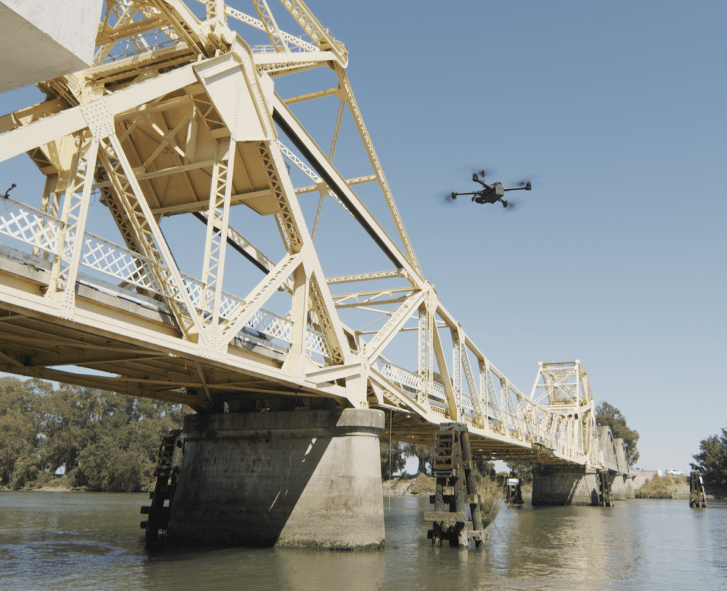
Autonomous drones like those developed by Skydio can be useful for inspecting critical infrastructure such as bridges. (Photo: Skydio)
Departments of Transportation are increasingly using autonomous drones for monitoring and performing inspections of critical infrastructure such as bridges and highways. An autonomous drone can eliminate the need for a manual inspection which can be difficult and dangerous. Autonomous drone inspections are also less expensive to perform. Departments of Transportation (DOTs) in Alaska, North Carolina, New York, and other states have found that using autonomous drone technology to monitor and inspect infrastructure can improve workflow efficiency and lower costs.
Autonomous drones, such as those developed by the company Skydio, can easily be operated by less experienced pilots. “They are a lot easier to fly than a traditional manual drone,” according to David Buhrman, Senior Solutions Engineer.
Skydio closed $100 million in Series C funding in the summer of 2020. Shortly after that, the Defense Innovation Unit approved a version of the X2 model, along with four other drones, as trusted purchases for government customers. In the summer of 2021, the FAA granted BNSF Railway approval to remotely operate dock-based Skydio drones for BVLOS operations, including infrastructure inspection.
The unmanned aircraft systems (UAS) program within Alaska’s DOT frequently employs drones to perform routine inspections of infrastructure. Ryan Marlow, UAS Program Coordinator, Statewide Aviation for the Alaska Department of Transportation (AKDOT), remarked that they perform an average of 8–12 bridge inspections each day.
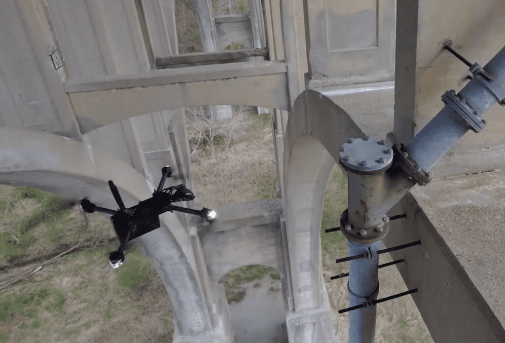
AKDOT’s UAS program team currently uses Skydio’s autonomous drones for infrastructure inspections. They have had particular success using the Skydio 3D Scan software that automates the data capture process for generating 3D models of infrastructure. “This has been a fantastic breakthrough for us—to take all of that data and visualize it, and do change detection,” Marlow shared during a webinar hosted by AUVSI (Association for Unmanned Vehicle Systems International) last week.
He commented that the interface of the 3D Scan software is easy to use. “We’re seeing a lot of success with the 3D Scan with our engineers in the field.”
They first used the technology to perform an autonomous 3D scan on a pedestrian bridge over a creek in Juneau. Although the bridge had undergone numerous manual inspections, the drone captured visuals of a previously undetected structural issue that needed repair. “We were able to see something leaking out of the timbers,” Marlow said. “It allowed us to capture this environment in a way that we’d never been able to visualize.”
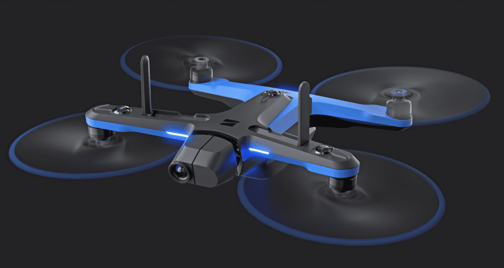
Skydio’s 2+ model was launched earlier this year at CES. (Photo: Skydio)
The data collected via autonomous drones is also useful for measuring changes in critical infrastructure over time, which helps the AKDOT to prioritize the most urgent repairs.
Skydio’s UAS uses six 4K cameras working in tandem to visualize its surroundings, explained David Buhrman of Skydio. Navigation is supported by deep learning algorithms and advanced predictive artificial intelligence to make decisions. The Skydio Autonomy Enterprise enables close proximity obstacle avoidance which is particularly useful for safely capturing data during infrastructure inspections.
In 2020, North Carolina’s DOT was granted approval from the Federal Aviation Administration to operate Skydio drones beyond visual line of sight (BVLOS) for bridge inspections. This followed extensive collaboration between NCDOT, Skydio, and the FAA. A key advantage of Skydio’s technology is that its drones do not require GPS, making them ideal for inspections of the more than 13,500 bridges in the state of North Carolina.
The Skydio 2 model was the company’s entry into the consumer market. They quickly realized that it would be useful for enterprise solutions. The Skydio 2+ model, an updated version, was introduced at the end of 2021. It offers “360 degrees of obstacle avoidance based on nine onboard deep neural networks,” stated Buhrman. “We use these networks to identify things like, for motion tracking, people and vehicles.”
He described the enterprise edition, Skydio X2, as an “enterprise workhorse, a ‘ruggedized’ alternative to the 2+.” The X2 model was released last year along with the Skydio Enterprise Controller. The airframe construction of the X2 is based on magnesium and carbon fiber composites, and the controller is built with high-impact plastics as well as a protective cover and built-in antenna.
Skydio’s X2 model was designed to be more rugged for providing enterprise solutions. (Photo: Skydio)
Skydio partnered with DroneDeploy a few months ago to automate the data analysis process. Imagery from the Skydio Cloud is imported to the DroneDeploy platform for immediate processing, Buhrman explained.
“Under Part 107, the FAA does require a remote pilot in command to be present with the aircraft that can see attitude, altitude, and position of the aircraft at all times,” he remarked. “There is no directive about flying in an automated fashion, as long as the pilot can take over for manual flight in an emergency situation.”
Sean Nordstrom, Product Marketing Manager for Skydio, described some of the limitations of manual drone inspections. It is challenging to operate around low bridges, for example, and it is also difficult to operate in a GPS-denied environment. “Prohibitively high pilot skill is required, and manual drones are expensive,” he said.
Enabling BVLOS drone flight is also expensive, and it is notoriously difficult to receive a waiver from the FAA for BVLOS operations. Ground-based surveillance radar, another option, is expensive as well.
Transportation and other individual state agencies throughout the U.S. have been increasingly adopting the use of drones for infrastructure and asset inspections as well.
In partnership with the nonprofit NUAIR, the New York State Thruway Authority launched a pilot program to use drones to perform highway bridge inspections. UAS have the potential to examine components of bridges and other infrastructure that would be difficult to inspect manually, according to the Federal Highway Administration. According to the NYS Thruway Authority’s announcement about the pilot program, drones may improve safety for inspectors and lower overall inspection costs. Another benefit of using UAS is the digital images and video that the aircraft can capture.
The West Virginia Department of Transportation (WVDOT) has also used drones to improve safety and efficiency in performing aggregate stockpile inspections. The department stores numerous large piles of crushed rock, gravel, and other materials for use in road building and maintenance. Having a crew physically survey and inventory the stockpiles was inefficient and dangerous.
Following an initial $25,000 investment into drone equipment and pilots, the WVDOT calculated that the savings from just one month of using drones to survey stockpiles totaled more than $343,000. Manual surveying required 15 days of work by 42 employees, whereas the same workload was completed by 7 drone pilots over 9 days.
The WVDOT may expand its drone programs to perform road safety assessments and to assist in designing new road routes by providing topographical maps.
The post How Transportation Departments Are Using Advanced Drone Technology for Infrastructure Inspections appeared first on Aviation Today.
—————
Boost Internet Speed–
Free Business Hosting–
Free Email Account–
Dropcatch–
Free Secure Email–
Secure Email–
Cheap VOIP Calls–
Free Hosting–
Boost Inflight Wifi–
Premium Domains–
Free Domains